
File:Overview of the Northern Alaska Gas Hydrate Total Petroleum System.png
Size of this preview: 800 × 439 pixels. Other resolutions: 320 × 176 pixels | 831 × 456 pixels.
Original file (831 × 456 pixels, file size: 602 KB, MIME type: image/png)
| This is a file from the Wikimedia Commons. Information from its description page there is shown below. Commons is a freely licensed media file repository. You can help. |
Summary
| Description |
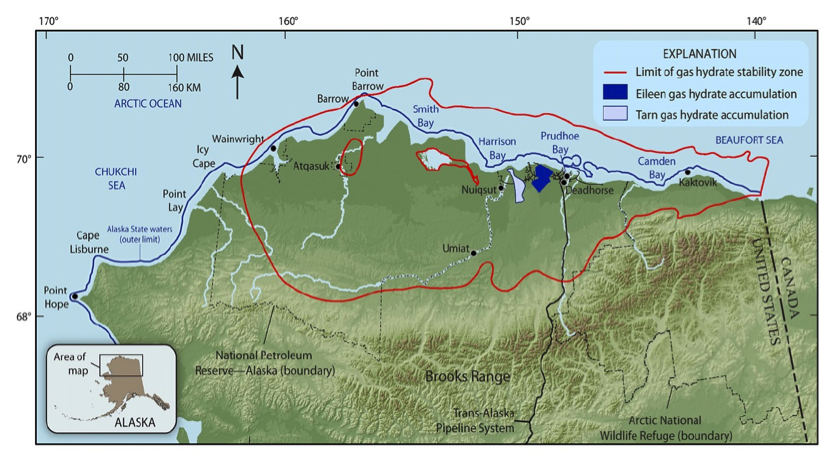
English: Map of Northern Alaska displaying the Gas Hydrate Total Petroleum System area and the additional outer limit of the expected gas hydrate stability zone |
|||
| Date | ||||
| Source | http://pubs.usgs.gov/fs/2008/3073/ | |||
| Author | U.S. Geological Survey | |||
| Permission (Reusing this file) |
|
Licensing
File history
Click on a date/time to view the file as it appeared at that time.
| Date/Time | Thumbnail | Dimensions | User | Comment | |
|---|---|---|---|---|---|
| current | 11:22, 4 July 2011 | | 831 × 456 (602 KB) | GRID-Arendal |
File usage
The following pages on the English Wikipedia use this file (pages on other projects are not listed):