
File:PMNM OverviewMap.jpg

Size of this preview: 800 × 484 pixels. Other resolutions: 320 × 193 pixels | 640 × 387 pixels | 1,024 × 619 pixels | 1,280 × 774 pixels | 2,850 × 1,723 pixels.
Original file (2,850 × 1,723 pixels, file size: 1.33 MB, MIME type: image/jpeg)
| This is a file from the Wikimedia Commons. Information from its description page there is shown below. Commons is a freely licensed media file repository. You can help. |
Summary
| Description |
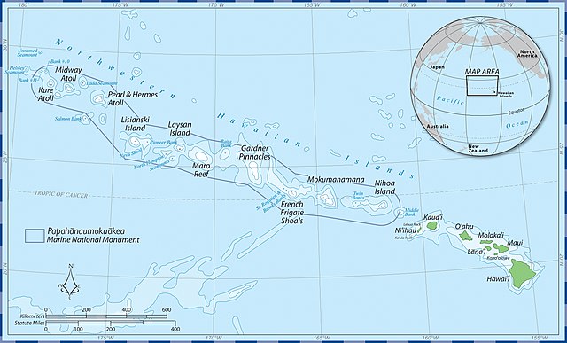
English: Boundaries of the Papahanaumokuakea Marine National Monument before 2016 |
| Date | |
| Source | Papahanaumokuakea National Marine Monument |
| Author | Papahanaumokuaka National Marine Monument NOAA Staff (myself included) |
| Camera location | | View this and other nearby images on: OpenStreetMap |
|---|
Licensing
This image is in the public domain because it contains materials that originally came from the U.S. National Oceanic and Atmospheric Administration, taken or made as part of an employee's official duties.
|
File history
Click on a date/time to view the file as it appeared at that time.
| Date/Time | Thumbnail | Dimensions | User | Comment | |
|---|---|---|---|---|---|
| current | 20:04, 18 November 2015 | | 2,850 × 1,723 (1.33 MB) | Luckylecky | User created page with UploadWizard |
File usage
The following pages on the English Wikipedia use this file (pages on other projects are not listed):
Global file usage
The following other wikis use this file:
- Usage on fa.wikipedia.org