
File:Pacific NW after storm, satellite view.jpg
Original file (3,200 × 2,400 pixels, file size: 3.28 MB, MIME type: image/jpeg)
| This is a file from the Wikimedia Commons. Information from its description page there is shown below. Commons is a freely licensed media file repository. You can help. |
Summary
| Description |
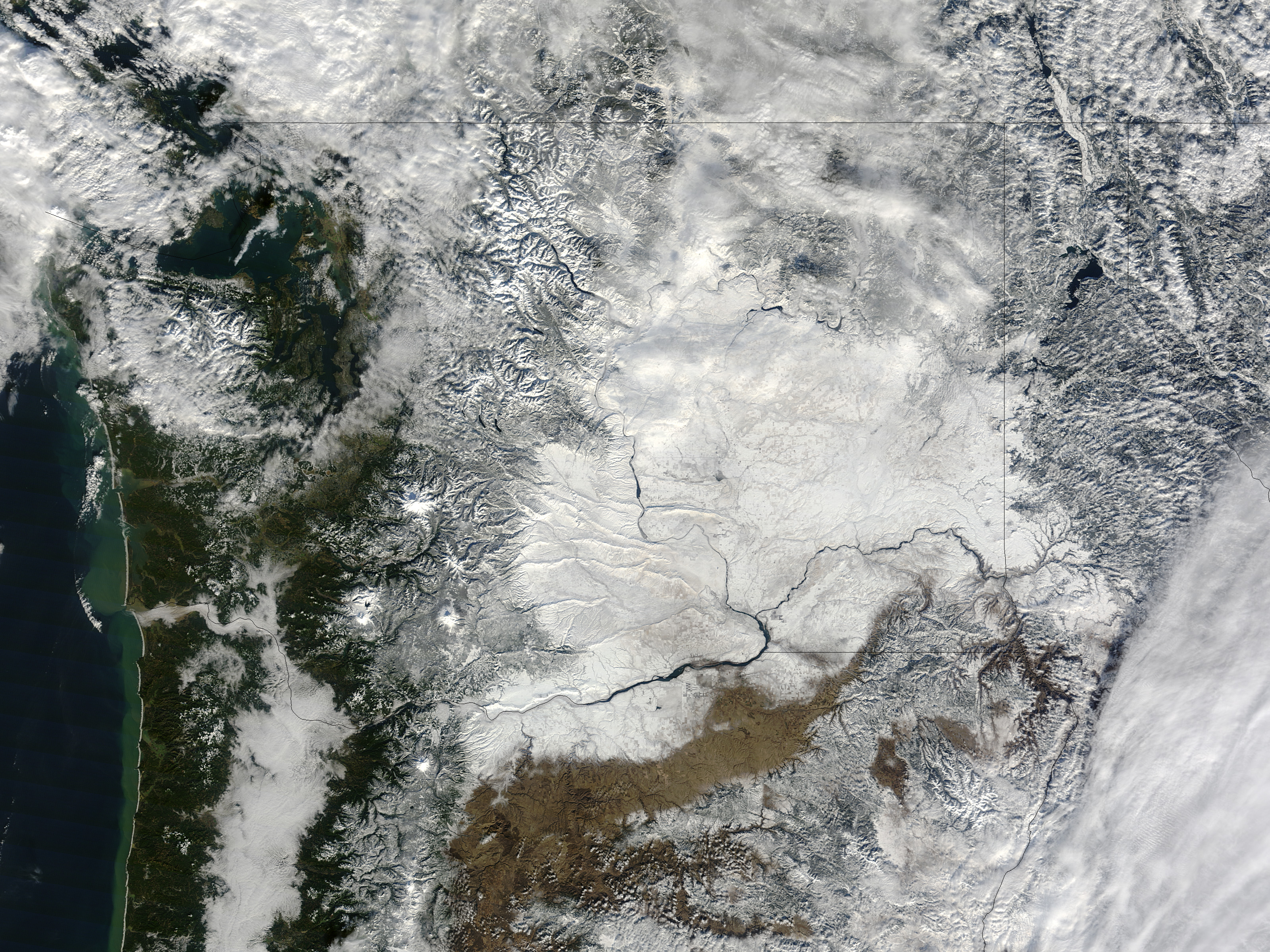
English: "A severe winter storm pummeled the Pacific Northwest in late January 2012, icing roads, downing power lines, and prompting avalanche warnings. On January 20, more than 250,000 customers were without electricity, as utility crews struggled to restore power, news sources said. Rising temperatures and potential new rainfall raised the possibility of flooding in the days that followed.
Snow still blanketed much of Washington state on January 23, 2012, when the Moderate Resolution Imaging Spectroradiometer (MODIS) on NASA’s Terra satellite captured this image. Snow blankets the region east of Seattle and Portland, stretching all the way to the Idaho border. In the band of forest along the Pacific Coast, snow may be more prevalent than it appears, as it is sometimes hidden from satellite imagery by trees. Warmer air blew into the region soon after the storm, adding to hazardous conditions. Flooding closed roads and forced some residents into emergency shelters. On January 23, KVAL reported that a fresh storm was approaching the region and might drop several inches of rain. The National Weather Service issued a flood warning for the Portland area, as the new round of rain had the potential to push rivers into flood stage." (state borders drawn) (description shortened and slightly modified from text on NASA website) |
| Date | |
| Source | [1], [2] |
| Author | NASA |
![[2]](http://eoimages.gsfc.nasa.gov/images/imagerecords/77000/77016/pacificnw_tmo_2012023_lrg.jpg)
Licensing
| This file is in the public domain in the United States because it was solely created by NASA. NASA copyright policy states that "NASA material is not protected by copyright unless noted". (See Template:PD-USGov, NASA copyright policy page or JPL Image Use Policy.) | ||
 |
Warnings:
|
File history
Click on a date/time to view the file as it appeared at that time.
| Date/Time | Thumbnail | Dimensions | User | Comment | |
|---|---|---|---|---|---|
| current | 23:20, 14 May 2013 | | 3,200 × 2,400 (3.28 MB) | Jsayre64 | {{Information |Description ={{en|1="A severe winter storm pummeled the Pacific Northwest in late January 2012, icing roads, downing power lines, and prompting avalanche warnings. On January 20, more than 250,000 customers were without electricity, a... |
File usage
Global file usage
The following other wikis use this file:
- Usage on www.wikidata.org