
File:Preston and Fulwood in 1950.svg

Size of this PNG preview of this SVG file: 758 × 492 pixels. Other resolutions: 320 × 208 pixels | 640 × 415 pixels | 1,024 × 665 pixels | 1,280 × 831 pixels | 2,560 × 1,662 pixels.
Original file (SVG file, nominally 758 × 492 pixels, file size: 54 KB)
| This is a file from the Wikimedia Commons. Information from its description page there is shown below. Commons is a freely licensed media file repository. You can help. |
Summary
| Description | |
| Date | (UTC) |
| Source |
This file was derived from: Preston UK ward map 2010 (blank).svg: |
| Author |
|
.svg)
Licensing
I, the copyright holder of this work, hereby publish it under the following license:
This file is licensed under the Creative Commons Attribution-Share Alike 3.0 Unported license.
Attribution: Dr Greg
- You are free:
- to share – to copy, distribute and transmit the work
- to remix – to adapt the work
- Under the following conditions:
- attribution – You must give appropriate credit, provide a link to the license, and indicate if changes were made. You may do so in any reasonable manner, but not in any way that suggests the licensor endorses you or your use.
- share alike – If you remix, transform, or build upon the material, you must distribute your contributions under the same or compatible license as the original.
Original upload log
This image is a derivative work of the following images:
- File:Preston_UK_ward_map_2010_(blank).svg licensed with Cc-by-sa-3.0
- 2011-04-24T22:48:11Z Nilfanion 1187x1305 (329725 Bytes) {{Information |Description=Map of Preston, Lancashire, UK with electoral wards shown. Equirectangular map projection on WGS 84 datum, with N/S stretched 165% Geographic limits: *West: 2.83W *East: 2.59W *North: 53.90N *Sout
Uploaded with derivativeFX
References
- Thorpe, P.H. (1950), Geographia plan of the County Borough of Preston & Fulwood U.D., Geographia Ltd, London
- (1953-55), OS 1-inch map of Preston, Ordnance Survey, Southampton
File history
Click on a date/time to view the file as it appeared at that time.
| Date/Time | Thumbnail | Dimensions | User | Comment | |
|---|---|---|---|---|---|
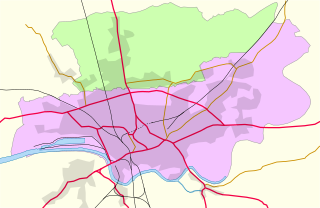
| current | 14:11, 21 April 2012 | | 758 × 492 (54 KB) | Dr Greg | == {{int:filedesc}} == {{Information |Description={{en|Map of en:Preston, Lancashire and en:Fulwood, Lancashire, in Lancashire, England in 1950. *{{color||{{0|00}}|bg=#f5c6ff}} en:County Borough of Preston *{{color||{{0|00}}|bg=#cdff... |
File usage
The following pages on the English Wikipedia use this file (pages on other projects are not listed):