
File:Pyrenees topo map-blank.jpg

Size of this preview: 800 × 475 pixels. Other resolutions: 320 × 190 pixels | 640 × 380 pixels | 1,024 × 608 pixels | 1,280 × 760 pixels | 2,560 × 1,520 pixels | 4,787 × 2,842 pixels.
Original file (4,787 × 2,842 pixels, file size: 4.82 MB, MIME type: image/jpeg)
| This is a file from the Wikimedia Commons. Information from its description page there is shown below. Commons is a freely licensed media file repository. You can help. |
Summary
| Description |
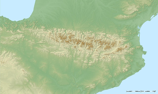
English: Large blank map showing the relief of the Pyrenees mountains.
Français : Carte vierge montrant le relief des Pyrénées.
UTM projection ; WGS84 geoid ; shaded relief (composite image of N-W, W and N lightning positions) |
||
| Date | May 2007 (modified September 2008) | ||
| Source |
Own work ;
|
||
| Author | Eric Gaba (Sting - fr:Sting) | ||
| Permission (Reusing this file) |
|
||
| Other versions |
[]
|


Licensing
I, the copyright holder of this work, hereby publish it under the following licenses:

|
Permission is granted to copy, distribute and/or modify this document under the terms of the GNU Free Documentation License, Version 1.2 or any later version published by the Free Software Foundation; with no Invariant Sections, no Front-Cover Texts, and no Back-Cover Texts. A copy of the license is included in the section entitled GNU Free Documentation License. |
| This file is licensed under the Creative Commons Attribution-Share Alike 3.0 Unported license. | ||
| ||
| This licensing tag was added to this file as part of the GFDL licensing update. |
This file is licensed under the Creative Commons Attribution-Share Alike 2.5 Generic, 2.0 Generic and 1.0 Generic license.
- You are free:
- to share – to copy, distribute and transmit the work
- to remix – to adapt the work
- Under the following conditions:
- attribution – You must give appropriate credit, provide a link to the license, and indicate if changes were made. You may do so in any reasonable manner, but not in any way that suggests the licensor endorses you or your use.
- share alike – If you remix, transform, or build upon the material, you must distribute your contributions under the same or compatible license as the original.
You may select the license of your choice.
File history
Click on a date/time to view the file as it appeared at that time.
| Date/Time | Thumbnail | Dimensions | User | Comment | |
|---|---|---|---|---|---|
| current | 04:50, 23 September 2008 | | 4,787 × 2,842 (4.82 MB) | Sting | New standard colors |
| 02:38, 31 May 2007 |  | 4,787 × 2,842 (4.84 MB) | Sting | Other type of compression | |
| 02:30, 31 May 2007 |  | 4,787 × 2,842 (4.82 MB) | Sting | {{Information |Description=Blank map showing the relief of the Pyrenees mountains |Source=Own work ;<br/>Topographic data : [http://www2.jpl.nasa.gov/srtm NASA Shuttle Radar Topography Mission] (SRTM3 v.2) (public domain) edited with [htt |
File usage
No pages on the English Wikipedia use this file (pages on other projects are not listed).
Global file usage
The following other wikis use this file:
- Usage on de.wikipedia.org
- Col du Tourmalet
- Col d’Aubisque
- Somport
- Col d’Aspin
- Col de Marie-Blanque
- Port de Pailhères
- Port de Balès
- Col de Peyresourde
- Col de Portet-d’Aspet
- Port d’Envalira
- Col de la Pierre Saint-Martin
- Port de Larrau
- Col Bagargui
- Col de Burdincurutcheta
- Col du Soulor
- Col du Portel
- Hourquette d’Ancizan
- Col de Banyuls
- Col du Portillon
- Port de Lers
- Col de Val Louron-Azet
- Col de Portel
- Col d’Ichère
- Col de la Hourcère
- Col d’Agnes
- Vorlage:Navigationsleiste Französische Pyrenäenpässe
- Col de la Core
- Col de Port
- Col de Latrape
- Col de Jau
- Usage on fr.wikipedia.org
- Usage on nl.wikipedia.org
View more global usage of this file.