
File:RG77-CWMF-W52-BoundCommRoute.JPG
Size of this preview: 187 × 600 pixels. Other resolutions: 75 × 240 pixels | 149 × 480 pixels | 727 × 2,331 pixels.
Original file (727 × 2,331 pixels, file size: 378 KB, MIME type: image/jpeg)
| This is a file from the Wikimedia Commons. Information from its description page there is shown below. Commons is a freely licensed media file repository. You can help. |
Summary
| Description |
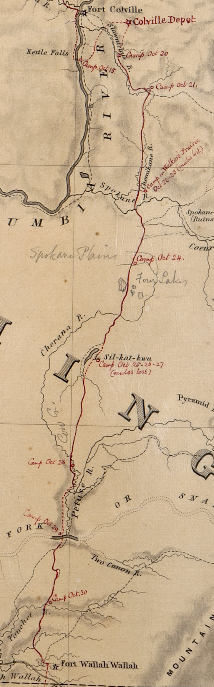
English: Portion of the Map of the Oregon and Washington Territory, compiled in the Bureau of Topogl. Engrs, chiefly for the military purposes by order of the Secretary of War 1859. Map RG77-CWMF-W52 |
| Date | |
| Source | National Archives and Records Administration Cartographic and Architectural Branch |
| Author | Department of War |
Washington Territory from Walla Walla to US Fort Colville
Licensing
This work is in the public domain in the United States because it is a work prepared by an officer or employee of the United States Government as part of that person’s official duties under the terms of Title 17, Chapter 1, Section 105 of the US Code.
Note: This only applies to original works of the Federal Government and not to the work of any individual U.S. state, territory, commonwealth, county, municipality, or any other subdivision. This template also does not apply to postage stamp designs published by the United States Postal Service since 1978. (See § 313.6(C)(1) of Compendium of U.S. Copyright Office Practices). It also does not apply to certain US coins; see The US Mint Terms of Use.
|
 | |
| This file has been identified as being free of known restrictions under copyright law, including all related and neighboring rights. | ||
File history
Click on a date/time to view the file as it appeared at that time.
| Date/Time | Thumbnail | Dimensions | User | Comment | |
|---|---|---|---|---|---|
| current | 15:19, 15 March 2015 | 727 × 2,331 (378 KB) | Srichart4 | User created page with UploadWizard |
File usage
The following pages on the English Wikipedia use this file (pages on other projects are not listed):