
File:RG77 CWMF N76 04.jpg

Original file (4,800 × 7,433 pixels, file size: 5.64 MB, MIME type: image/jpeg)
| This is a file from the Wikimedia Commons. Information from its description page there is shown below. Commons is a freely licensed media file repository. You can help. |
Summary
| Description |
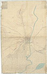
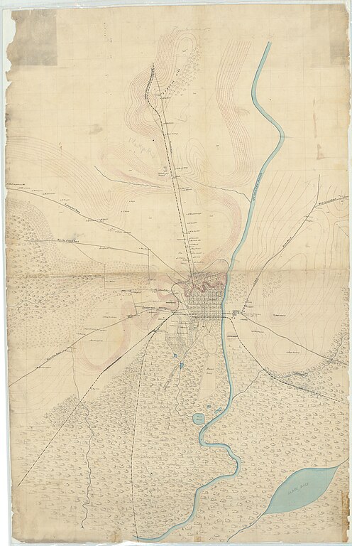
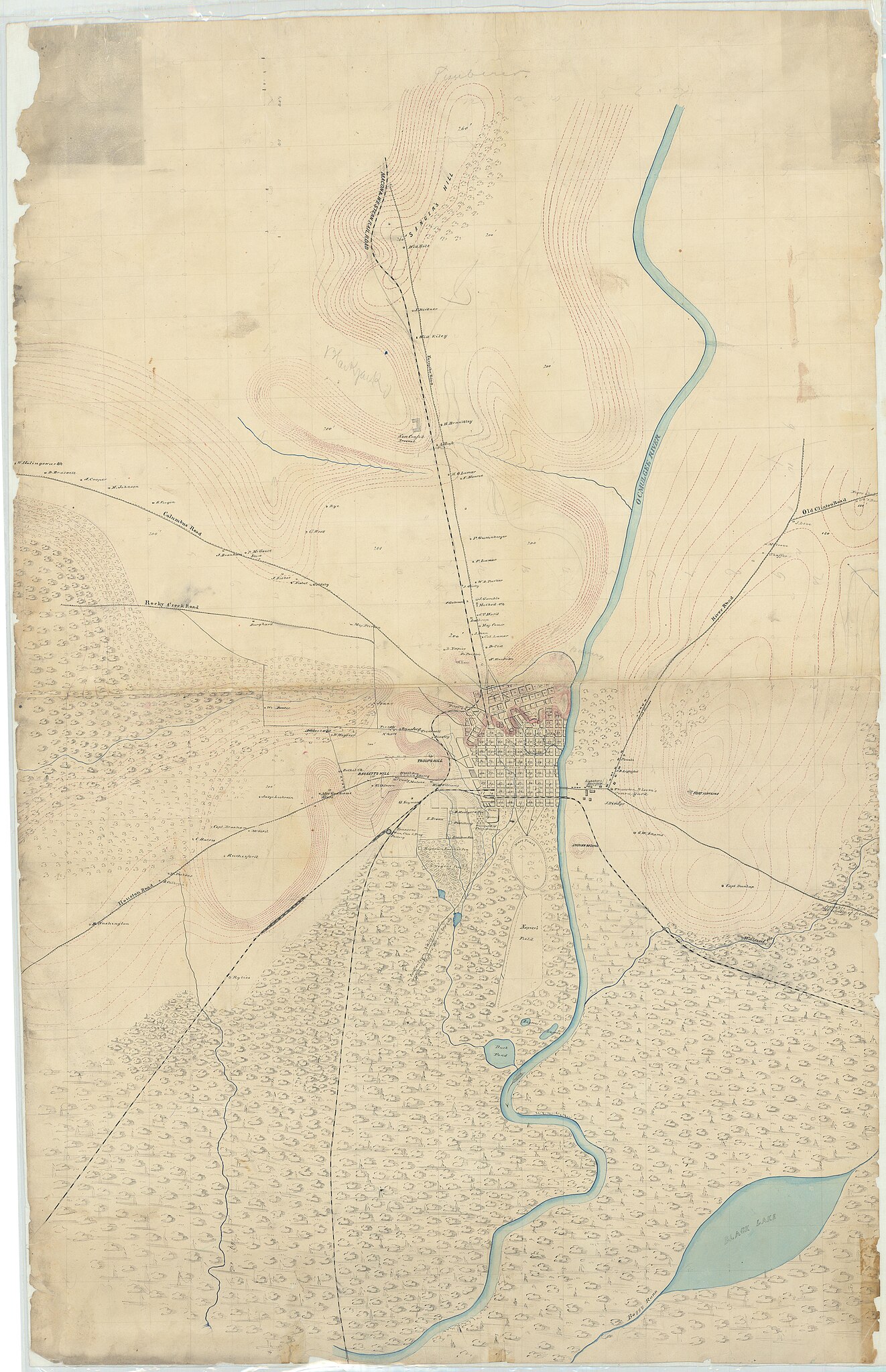
English: https://catalog.archives.gov/id/305649
Map of Macon and Vicinity. Compiled from Information by Capt. E. Ruger under the Direction of Lt. Col. J. G. Wharton, Top. Engineer, Hd. Quarters, Department of the Cumberland. Drawn by Chas. Helmle, Draughtsman. NAID: 305649 Local ID: 77-CWMF-N76 Maps and Charts Covers: ca. 1861–ca. 1865 The creator compiled or maintained the parent series, Civil Works Map File, between 1818–1947. This item documents the time period of ca. 1861–ca. 1865. Access: Unrestricted Use: Unrestricted Record Group 77 Records of the Office of the Chief of Engineers 1789 – 1999 Civil Works Map File 1818 – 1947 File Unit Georgia War Department. Office of the Chief of Engineers. 1818-9/18/1947 |
| Date | 1863–1865 |
| Source |
Record Group 77, Records of the Office of the Chief of Engineers; Civil Works Map File (CWMF); Georgia; Map Numbers N76-1, N76-2, and N76-3 (NAID 305649) https://catalog.archives.gov/id/305649 |
| Author | Compiled from Information by Capt. E. Ruger under the Direction of Lt. Col. J. G. Wharton, Top. Engineer, Hd. Quarters, Department of the Cumberland. Drawn by Chas. Helmle, Draughtsman. |
Licensing
This work is in the public domain in the United States because it was published (or registered with the U.S. Copyright Office) before January 1, 1929.
Public domain works must be out of copyright in both the United States and in the source country of the work in order to be hosted on the Commons. If the work is not a U.S. work, the file must have an additional copyright tag indicating the copyright status in the source country.
Note: This tag should not be used for sound recordings. |
This work is in the public domain in the United States because it is a work prepared by an officer or employee of the United States Government as part of that person’s official duties under the terms of Title 17, Chapter 1, Section 105 of the US Code.
Note: This only applies to original works of the Federal Government and not to the work of any individual U.S. state, territory, commonwealth, county, municipality, or any other subdivision. This template also does not apply to postage stamp designs published by the United States Postal Service since 1978. (See § 313.6(C)(1) of Compendium of U.S. Copyright Office Practices). It also does not apply to certain US coins; see The US Mint Terms of Use.
|
 | |
| This file has been identified as being free of known restrictions under copyright law, including all related and neighboring rights. | ||
File history
Click on a date/time to view the file as it appeared at that time.
| Date/Time | Thumbnail | Dimensions | User | Comment | |
|---|---|---|---|---|---|
| current | 17:19, 5 August 2024 | | 4,800 × 7,433 (5.64 MB) | Jengod | Uploaded a work by Compiled from Information by Capt. E. Ruger under the Direction of Lt. Col. J. G. Wharton, Top. Engineer, Hd. Quarters, Department of the Cumberland. Drawn by Chas. Helmle, Draughtsman. from Record Group 77, Records of the Office of the Chief of Engineers; Civil Works Map File (CWMF); Georgia; Map Numbers N76-1, N76-2, and N76-3 (NAID 305649) https://catalog.archives.gov/id/305649 with UploadWizard |