File:Republic of China edcp location map (disputed territories).svg
Appearance

Size of this PNG preview of this SVG file: 512 × 399 pixels. Other resolutions: 308 × 240 pixels | 616 × 480 pixels | 986 × 768 pixels | 1,280 × 998 pixels | 2,560 × 1,995 pixels.
Original file (SVG file, nominally 512 × 399 pixels, file size: 7.25 MB)
File history
Click on a date/time to view the file as it appeared at that time.
| Date/Time | Thumbnail | Dimensions | User | Comment | |
|---|---|---|---|---|---|
| current | 02:58, 31 July 2024 |  | 512 × 399 (7.25 MB) | Lilauid | 圖層整理,邊界小修正 |
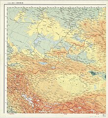
| 07:31, 30 July 2024 |  | 512 × 399 (7.26 MB) | Lilauid | 更新地圖,根據中華民國五十五年十月聯合勤務總司令部印之第二版二百五十萬分之一中華民國全圖更新邊界 | |
| 08:03, 25 July 2024 |  | 512 × 399 (6.22 MB) | Lilauid | 根據兩百五十萬比一中華民國地圖修正邊界 | |
| 13:12, 9 July 2024 |  | 512 × 399 (6.12 MB) | Lilauid | 修正邊界 | |
| 08:27, 15 June 2024 |  | 512 × 399 (6.24 MB) | Lilauid | 修訂和添加多處邊界 | |
| 22:46, 29 May 2024 |  | 512 × 399 (6.44 MB) | Lilauid | 根據內政部1987年出版的中華民國全圖(兩百五十萬分之一)修改、細化邊界 | |
| 10:20, 29 May 2024 |  | 512 × 399 (6.4 MB) | Lilauid | 修正邊界 | |
| 06:26, 28 May 2024 |  | 512 × 399 (6.39 MB) | Lilauid | {{Information |Description=包含爭議領土的中華民國行政區劃地圖(公告行政區劃) |Source=File:Republic_of_China_edcp_location_map.svg |Date=2024-05-28 |Author=Lilauid |Permission= |other_versions={{Template:中華民國行政區劃地圖}}}} |
File usage
The following pages on the English Wikipedia use this file (pages on other projects are not listed):
Global file usage
The following other wikis use this file:
- Usage on ca.wikipedia.org
- Usage on es.wikipedia.org
- Usage on www.wikidata.org
- Usage on zh.wikipedia.org
View more global usage of this file.


