
File:SatJadebusen-Wesermuendung.jpg

Size of this preview: 800 × 590 pixels. Other resolutions: 320 × 236 pixels | 640 × 472 pixels | 1,024 × 755 pixels | 1,280 × 944 pixels.
Original file (1,280 × 944 pixels, file size: 270 KB, MIME type: image/jpeg)
| This is a file from the Wikimedia Commons. Information from its description page there is shown below. Commons is a freely licensed media file repository. You can help. |
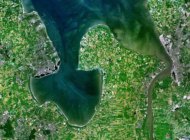
- Satellitenaufnahme Jadebusen mit Wilhelmshaven und Wesermündung mit Bremerhaven
- from Nasa World Wind - Free Satellite Image
| This image is in the public domain because it is a screenshot from NASA’s globe software World Wind using a public domain layer, such as Blue Marble, MODIS, Landsat, SRTM, USGS or GLOBE.
|
 |
File history
Click on a date/time to view the file as it appeared at that time.
| Date/Time | Thumbnail | Dimensions | User | Comment | |
|---|---|---|---|---|---|
| current | 11:05, 8 January 2006 | | 1,280 × 944 (270 KB) | Godewind | * Satellitenaufnahme Jadebusen mit Wilhelmshaven und Wesermündung mit Bremerhaven * from Nasa World Wind - Free Satellite Image {{PD-USGov}} Category:Satellite photos Category:Bremerhaven, Germany Category:Wilhelmshaven, Germany |
File usage
The following pages on the English Wikipedia use this file (pages on other projects are not listed):
Global file usage
The following other wikis use this file:
- Usage on ang.wikipedia.org
- Usage on azb.wikipedia.org
- Usage on ceb.wikipedia.org
- Usage on cs.wikipedia.org
- Usage on de.wikipedia.org
- Usage on eo.wikipedia.org
- Usage on es.wikipedia.org
- Usage on et.wikipedia.org
- Usage on frr.wikipedia.org
- Usage on fy.wikipedia.org
- Usage on hu.wikipedia.org
- Usage on it.wikipedia.org
- Usage on nds.wikipedia.org
- Usage on nl.wikipedia.org
- Usage on pl.wikipedia.org
- Usage on ru.wikipedia.org
- Usage on stq.wikipedia.org
- Usage on sv.wikipedia.org
- Usage on www.wikidata.org