
File:Satterlee-heights.jpg
Size of this preview: 750 × 600 pixels. Other resolutions: 300 × 240 pixels | 600 × 480 pixels | 1,000 × 800 pixels.
Original file (1,000 × 800 pixels, file size: 103 KB, MIME type: image/jpeg)
| This is a file from the Wikimedia Commons. Information from its description page there is shown below. Commons is a freely licensed media file repository. You can help. |
Summary
| Description |
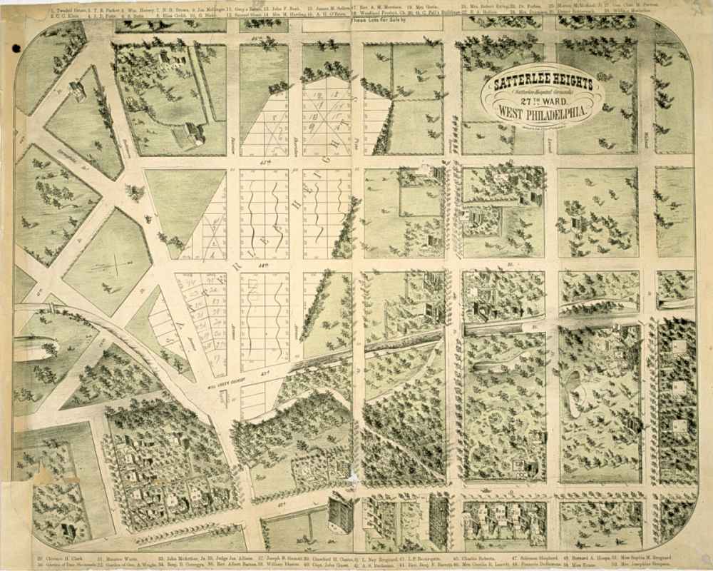
English: An illustration of existing and proposed uses of land in West Philadelphia, produced around 1869 by real estate developers who sought to sell plots of land on the site of the Union's Satterlee Civil War hospital. Drawn with the west at the top, the map shows (at bottom left) the area that will become Clark Park. It also shows the part of Mill Creek that was then above ground; the entirety was ultimately buried. This image, now in the public domain due to its age, was originally supplied by the Library Company of Philadelphia to Matthew Grubel, who posted it as part of a work called "The Building of West Philadelphia" (http://www.archives.upenn.edu/histy/features/wphila/exhbts/grubel/index.html) |
| Date | |
| Source | http://www.archives.upenn.edu/histy/features/wphila/exhbts/grubel/24develop2.html. |
| Author | Herline & Co. Lithographers [1869-70] |
Licensing
This media file is in the public domain in the United States. This applies to U.S. works where the copyright has expired, often because its first publication occurred prior to January 1, 1929, and if not then due to lack of notice or renewal. See this page for further explanation.
|
 | |
 |
This image might not be in the public domain outside of the United States; this especially applies in the countries and areas that do not apply the rule of the shorter term for US works, such as Canada, Mainland China (not Hong Kong or Macao), Germany, Mexico, and Switzerland. The creator and year of publication are essential information and must be provided. See Wikipedia:Public domain and Wikipedia:Copyrights for more details.
|
File history
Click on a date/time to view the file as it appeared at that time.
| Date/Time | Thumbnail | Dimensions | User | Comment | |
|---|---|---|---|---|---|
| current | 15:53, 18 August 2011 | | 1,000 × 800 (103 KB) | PRRfan | {{Information |Description ={{en|1=An illustration of existing and proposed uses of land in West Philadelphia, produced around 1869 by real estate developers who sought to sell plots of land on the site of the Union's Satterlee Civil War hospital. Draw |
File usage
The following pages on the English Wikipedia use this file (pages on other projects are not listed):
Global file usage
The following other wikis use this file:
- Usage on ja.wikipedia.org