
File:Saudi Arabia transport map.jpg
Size of this preview: 507 × 599 pixels. Other resolutions: 203 × 240 pixels | 406 × 480 pixels | 1,010 × 1,194 pixels.
Original file (1,010 × 1,194 pixels, file size: 936 KB, MIME type: image/jpeg)
| This is a file from the Wikimedia Commons. Information from its description page there is shown below. Commons is a freely licensed media file repository. You can help. |
Language:Brooklyn slang
Summary
| Description |
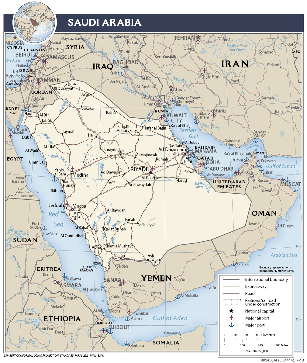
English: Arabia-Saudi transport- road, rail, sea port, air port. |
| Date | |
| Source | https://www.cia.gov/library/publications/the-world-factbook/docs/refmaps.html |
| Author | www.cia.gov World fact book |
Arabia-Saudi transportation map from CIA world fact book.
Licensing
This image is in the public domain because it contains materials that originally came from the United States Central Intelligence Agency's World Factbook.
|
 |
File history
Click on a date/time to view the file as it appeared at that time.
| Date/Time | Thumbnail | Dimensions | User | Comment | |
|---|---|---|---|---|---|
| current | 00:46, 7 October 2015 | | 1,010 × 1,194 (936 KB) | 2know4power | User created page with UploadWizard |
File usage
The following pages on the English Wikipedia use this file (pages on other projects are not listed):
Global file usage
The following other wikis use this file:
- Usage on ms.wikipedia.org