
File:Scharley Szarlej mine field.jpg
Size of this preview: 800 × 600 pixels. Other resolutions: 320 × 240 pixels | 640 × 480 pixels | 1,024 × 768 pixels | 1,280 × 960 pixels | 1,778 × 1,333 pixels.
Original file (1,778 × 1,333 pixels, file size: 357 KB, MIME type: image/jpeg)
| This is a file from the Wikimedia Commons. Information from its description page there is shown below. Commons is a freely licensed media file repository. You can help. |
Summary
| Description |
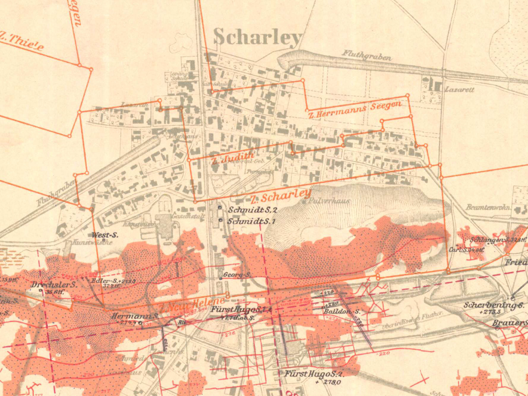
English: Field boundaries of zinc ores mine Scharley (pol. Szarlej) in Scharley (pol. Szarlej; now Piekary Śląskie, Poland), part of German geological map. Orange colour marks deposit of calamine.
Polski: Granice pola kopalni rud cynku Szarlej (Scharley) w Szarleju, obecnie Piekary Śląskie; fragment niemieckiej mapy geologicznej. Kolorem pomarańczowym zaznaczono złoże galmanu. |
| Date | |
| Source | Karte des Oberschlesisches Erzbergbaues. Nr 16 Scharley, 1912. |
| Author | Königlichen Oberbergamt in Breslau, lith. anst. by Leopold Kraatz from Berlin |
Licensing
|
This work is in the public domain in its country of origin and other countries and areas where the copyright term is the author's life plus 70 years or fewer. This work is in the public domain in the United States because it was published (or registered with the U.S. Copyright Office) before January 1, 1929. | |
| This file has been identified as being free of known restrictions under copyright law, including all related and neighboring rights. | |
File history
Click on a date/time to view the file as it appeared at that time.
| Date/Time | Thumbnail | Dimensions | User | Comment | |
|---|---|---|---|---|---|
| current | 14:45, 21 November 2017 | | 1,778 × 1,333 (357 KB) | Gower | User created page with UploadWizard |
File usage
The following pages on the English Wikipedia use this file (pages on other projects are not listed):
Global file usage
The following other wikis use this file:
- Usage on pl.wikipedia.org