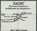
File:Schutzgebiet der Marshall-Inseln-Deutscher Kolonialatlas 1897-Nauru.jpg
Appearance
Schutzgebiet_der_Marshall-Inseln-Deutscher_Kolonialatlas_1897-Nauru.jpg (634 × 532 pixels, file size: 100 KB, MIME type: image/jpeg)
File history
Click on a date/time to view the file as it appeared at that time.
| Date/Time | Thumbnail | Dimensions | User | Comment | |
|---|---|---|---|---|---|
| current | 17:47, 18 October 2016 |  | 634 × 532 (100 KB) | Mauerquadrant | Cropped 15 % horizontally and 16 % vertically using CropTool with precise mode. |
| 17:46, 18 October 2016 |  | 750 × 634 (134 KB) | Mauerquadrant | File:Schutzgebiet der Marshall-Inseln-Deutscher Kolonialatlas 1897-Justus Perthes-Karte 30.jpg cropped 93 % horizontally and 92 % vertically using CropTool with precise mode. |
File usage
The following 3 pages use this file:
Global file usage
The following other wikis use this file:
- Usage on es.wikipedia.org


