
File:Sherwood Forest-1961.jpg
No higher resolution available.
Sherwood_Forest-1961.jpg (514 × 398 pixels, file size: 46 KB, MIME type: image/jpeg)
| This is a file from the Wikimedia Commons. Information from its description page there is shown below. Commons is a freely licensed media file repository. You can help. |
Summary
|
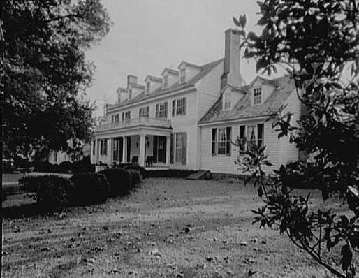
This is an image of a place or building that is listed on the National Register of Historic Places in the United States of America. Its reference number is 66000922. |
| Description |
English: John Tyler, Sherwood Forest, residence in Virginia. Exterior. |
||
| Date | |||
| Source |
|
||
| Author | Gottscho, Samuel H. (Samuel Herman), 1875-1971, photographer. | ||
| Permission (Reusing this file) |
According to the Library of Congress, photos from this collection have been released into the public domain by the heirs of the copyright holder.[1] | ||
| Other versions |
|


| Object location | | View this and other nearby images on: OpenStreetMap |
|---|
Licensing
The heirs of this work's copyright holder (usually the creator) have released it into the public domain. This applies worldwide.
In some countries this may not be legally possible; if so: |
Original upload log
The original description page was here. All following user names refer to en.wikipedia.
- 2006-12-03 01:28 The Mystery Man 514×398×8 (46686 bytes) {{PD-LOC}} http://lcweb2.loc.gov/cgi-bin/query/D?gottscho:32:./temp/~pp_QcsY::@@@mdb=fsaall,app,brum,detr,swann,look,gottscho,pan,horyd,genthe,var,cai,cd,hh,yan,bbcards,lomax,ils,prok,brhc,nclc,matpc,iucpub,tgmi,lamb
File history
Click on a date/time to view the file as it appeared at that time.
| Date/Time | Thumbnail | Dimensions | User | Comment | |
|---|---|---|---|---|---|
| current | 01:41, 13 May 2008 | | 514 × 398 (46 KB) | File Upload Bot (Magnus Manske) | {{BotMoveToCommons|en.wikipedia}} {{Information |Description={{en|http://lcweb2.loc.gov/cgi-bin/query/D?gottscho:32:./temp/~pp_QcsY::@@@mdb=fsaall,app,brum,detr,swann,look,gottscho,pan,horyd,genthe,var,cai,cd,hh,yan,bbcards,lomax,ils,prok,brhc,nclc,matpc |
File usage
The following pages on the English Wikipedia use this file (pages on other projects are not listed):
Global file usage
The following other wikis use this file:
- Usage on en.wikivoyage.org
- Usage on fr.wikipedia.org
- Usage on it.wikipedia.org
- Usage on kk.wikipedia.org
- Usage on ml.wikipedia.org
- Usage on pt.wikipedia.org
- Usage on ru.wikipedia.org
- Usage on sr.wikipedia.org
- Usage on uk.wikipedia.org
- Usage on www.wikidata.org
- Usage on zh.wikipedia.org