
File:Sint Servaasbrug2.jpg

Size of this preview: 800 × 600 pixels. Other resolutions: 320 × 240 pixels | 640 × 480 pixels | 1,024 × 768 pixels | 1,280 × 960 pixels | 2,048 × 1,536 pixels.
Original file (2,048 × 1,536 pixels, file size: 1.59 MB, MIME type: image/jpeg)
| This is a file from the Wikimedia Commons. Information from its description page there is shown below. Commons is a freely licensed media file repository. You can help. |
Summary
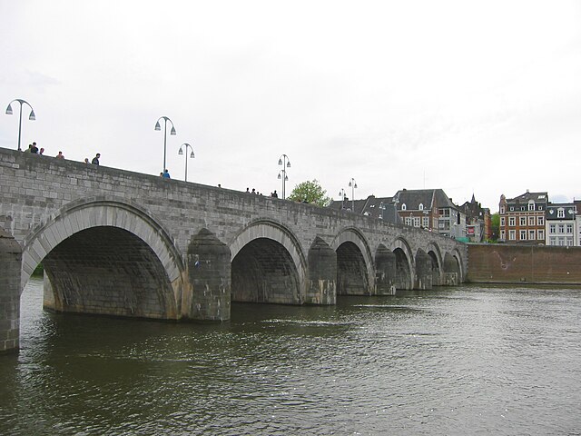
Saint Servatius bridge (Dutch: Sint Servaasbrug), 2005:05:21 16:29:16
| Camera location | | View this and other nearby images on: OpenStreetMap |
|---|
(precision: 20 m)
Licensing
| I, the copyright holder of this work, release this work into the public domain. This applies worldwide. In some countries this may not be legally possible; if so: I grant anyone the right to use this work for any purpose, without any conditions, unless such conditions are required by law. |
File history
Click on a date/time to view the file as it appeared at that time.
| Date/Time | Thumbnail | Dimensions | User | Comment | |
|---|---|---|---|---|---|
| current | 16:59, 22 January 2006 | | 2,048 × 1,536 (1.59 MB) | Cepheus~commonswiki | Saint Servatius bridge (Dutch: Sint Servaasbrug), 2005:05:21 16:29:16 |
File usage
The following pages on the English Wikipedia use this file (pages on other projects are not listed):
Global file usage
The following other wikis use this file:
- Usage on af.wikipedia.org
- Usage on ca.wikipedia.org
- Usage on da.wikipedia.org
- Usage on fa.wikipedia.org
- Usage on fr.wikipedia.org
- Usage on it.wikivoyage.org
- Usage on la.wikipedia.org
- Usage on li.wikipedia.org
- Usage on nds-nl.wikipedia.org
- Usage on nl.wikipedia.org
- Usage on nn.wikipedia.org
- Usage on pl.wiktionary.org
- Usage on sh.wikipedia.org
- Usage on sr.wikipedia.org
- Usage on ta.wiktionary.org
- Usage on tr.wikipedia.org
- Usage on vec.wikipedia.org
- Usage on vi.wikipedia.org