
File:Site of Leamside station (geograph 2582589).jpg
No higher resolution available.
Site_of_Leamside_station_(geograph_2582589).jpg (640 × 480 pixels, file size: 140 KB, MIME type: image/jpeg)
| This is a file from the Wikimedia Commons. Information from its description page there is shown below. Commons is a freely licensed media file repository. You can help. |
.jpg)
Summary
| Description |
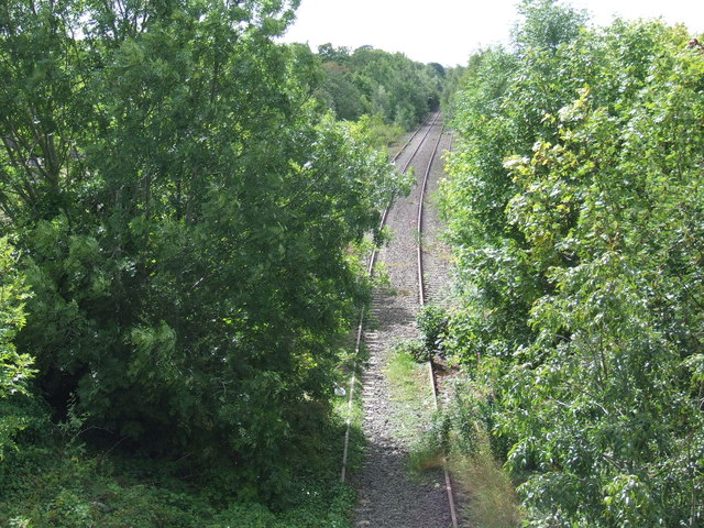
English: Site of Leamside station There is little sign now of the railway station which once occupied this site. The railway line through Leamside formed part of the original railway route from London to Edinburgh. Long distance trains were diverted onto current route through Durham, which is more direct, when that line opened in 1872. Local passenger trains continued to run on the line through Leamside until the 1960s, although Leamside station closed in 1953. The line was also busy with freight and was also a useful diversion route for express trains at times when the main line via Durham was closed for engineering work. The railway line fell into disuse in around 1992. It is currently "mothballed" - still owned by Network Rail, in case it is needed to be brought back into use in the future, but not currently maintained. |
| Date | |
| Source | From geograph.org.uk |
| Author | Malc McDonald |
| Permission (Reusing this file) |
Creative Commons Attribution Share-alike license 2.0 |
| Attribution (required by the license) | Malc McDonald / Site of Leamside station / |
| Camera location | | View this and other nearby images on: OpenStreetMap |
|---|
.jpg¶ms=054.813193_N_-001.513249_E_globe:Earth_type:camera_source:geograph-osgb36(NZ31384659)_heading:202.00&language=en)
| Object location | | View this and other nearby images on: OpenStreetMap |
|---|
.jpg¶ms=054.813010_N_-001.513410_E_globe:Earth_class:object_type:object_source:geograph-osgb36(NZ31374657)_heading:202.00&language=en)
Licensing

|
This image was taken from the Geograph project collection. See this photograph's page on the Geograph website for the photographer's contact details. The copyright on this image is owned by Malc McDonald and is licensed for reuse under the Creative Commons Attribution-ShareAlike 2.0 license.
|
This file is licensed under the Creative Commons Attribution-Share Alike 2.0 Generic license.
Attribution: Malc McDonald
- You are free:
- to share – to copy, distribute and transmit the work
- to remix – to adapt the work
- Under the following conditions:
- attribution – You must give appropriate credit, provide a link to the license, and indicate if changes were made. You may do so in any reasonable manner, but not in any way that suggests the licensor endorses you or your use.
- share alike – If you remix, transform, or build upon the material, you must distribute your contributions under the same or compatible license as the original.
File history
Click on a date/time to view the file as it appeared at that time.
| Date/Time | Thumbnail | Dimensions | User | Comment | |
|---|---|---|---|---|---|
| current | 12:18, 2 November 2020 | | 640 × 480 (140 KB) | Lamberhurst | Transferred from geograph.co.uk using [https://tools.wmflabs.org/geograph2commons/ geograph2commons] |
File usage
The following pages on the English Wikipedia use this file (pages on other projects are not listed):
.jpg)