
File:Source of the River Wey - geograph.org.uk - 370191.jpg
No higher resolution available.
Source_of_the_River_Wey_-_geograph.org.uk_-_370191.jpg (640 × 477 pixels, file size: 91 KB, MIME type: image/jpeg)
| This is a file from the Wikimedia Commons. Information from its description page there is shown below. Commons is a freely licensed media file repository. You can help. |
Summary
| Description |
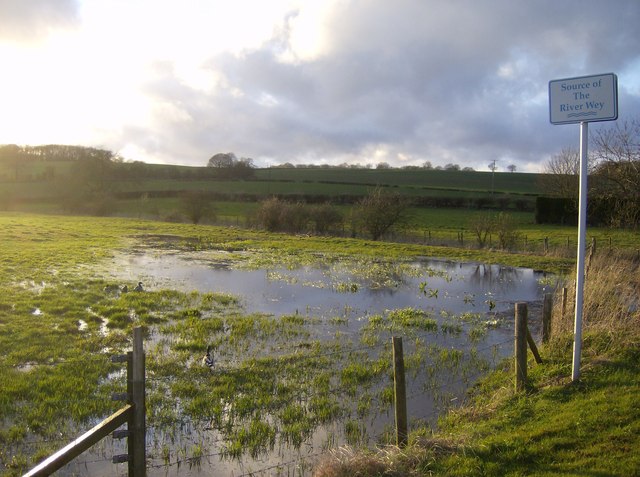
English: Source of the River Wey On the B3349 just north of its junction with a local road to Alton town centre. This is looking north-west with the setting sun having about 10 minutes to go on the western horizon. The water meadows here means that the actual source will vary depending on the amount of rainfall we have had. There is a culvert under the road (to the right) which becomes the actual river. |
| Date | |
| Source | From geograph.org.uk |
| Author | Graham Horn |
| Attribution (required by the license) | Graham Horn / Source of the River Wey / |
| Camera location | | View this and other nearby images on: OpenStreetMap |
|---|
_heading:292.00&language=en)
| Object location | | View this and other nearby images on: OpenStreetMap |
|---|
_heading:292.00&language=en)
Licensing

|
This image was taken from the Geograph project collection. See this photograph's page on the Geograph website for the photographer's contact details. The copyright on this image is owned by Graham Horn and is licensed for reuse under the Creative Commons Attribution-ShareAlike 2.0 license.
|
This file is licensed under the Creative Commons Attribution-Share Alike 2.0 Generic license.
Attribution: Graham Horn
- You are free:
- to share – to copy, distribute and transmit the work
- to remix – to adapt the work
- Under the following conditions:
- attribution – You must give appropriate credit, provide a link to the license, and indicate if changes were made. You may do so in any reasonable manner, but not in any way that suggests the licensor endorses you or your use.
- share alike – If you remix, transform, or build upon the material, you must distribute your contributions under the same or compatible license as the original.
File history
Click on a date/time to view the file as it appeared at that time.
| Date/Time | Thumbnail | Dimensions | User | Comment | |
|---|---|---|---|---|---|
| current | 21:28, 4 January 2011 | | 640 × 477 (91 KB) | GeographBot | == {{int:filedesc}} == {{Information |description={{en|1=Source of the River Wey On the B3349 just north of its junction with a local road to Alton town centre. This is looking north-west with the setting sun having about 10 minutes to go on the western |
File usage
The following pages on the English Wikipedia use this file (pages on other projects are not listed):