
File:Stable Mews, Hall Avenue, Worthing - geograph.org.uk - 656643.jpg
No higher resolution available.
Stable_Mews,_Hall_Avenue,_Worthing_-_geograph.org.uk_-_656643.jpg (640 × 480 pixels, file size: 88 KB, MIME type: image/jpeg)
| This is a file from the Wikimedia Commons. Information from its description page there is shown below. Commons is a freely licensed media file repository. You can help. |
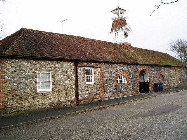
This is a photo of listed building number 1250302. |
Summary
| Description |
English: Stable Mews, Hall Avenue, Offington, Worthing, West Sussex. Built in the 18th century as the stables of Offington Hall. In the 20th century it was a riding school. |
| Date | |
| Source | From geograph.org.uk; transferred by User:Multichill using geograph_org2commons. |
| Author | Peter Holmes |
| Permission (Reusing this file) |
Creative Commons Attribution Share-alike license 2.0 |
| Attribution (required by the license) | Peter Holmes / Stable Mews, Hall Avenue, Worthing / |
| Camera location | | View this and other nearby images on: OpenStreetMap |
|---|
| Object location | | View this and other nearby images on: OpenStreetMap |
|---|
_region:GB-ENG_heading:315.00&language=en)
Licensing

|
This image was taken from the Geograph project collection. See this photograph's page on the Geograph website for the photographer's contact details. The copyright on this image is owned by Peter Holmes and is licensed for reuse under the Creative Commons Attribution-ShareAlike 2.0 license.
|
This file is licensed under the Creative Commons Attribution-Share Alike 2.0 Generic license.
Attribution: Peter Holmes
- You are free:
- to share – to copy, distribute and transmit the work
- to remix – to adapt the work
- Under the following conditions:
- attribution – You must give appropriate credit, provide a link to the license, and indicate if changes were made. You may do so in any reasonable manner, but not in any way that suggests the licensor endorses you or your use.
- share alike – If you remix, transform, or build upon the material, you must distribute your contributions under the same or compatible license as the original.
File history
Click on a date/time to view the file as it appeared at that time.
| Date/Time | Thumbnail | Dimensions | User | Comment | |
|---|---|---|---|---|---|
| current | 17:35, 24 December 2009 | | 640 × 480 (88 KB) | File Upload Bot (Magnus Manske) | == Summary == {{Information |Description=Stable Mews, Hall Avenue, Worthing |Source=From [http://www.geograph.org.uk/photo/656643 geograph.org.uk]; transferd by User:Multichill using [http://toolserver.org/~magnus/geograph_org2commons.php geograph_org |
File usage
The following pages on the English Wikipedia use this file (pages on other projects are not listed):
Global file usage
The following other wikis use this file: