
File:Vas county map.jpg

Size of this preview: 760 × 600 pixels. Other resolutions: 304 × 240 pixels | 608 × 480 pixels | 973 × 768 pixels | 1,280 × 1,010 pixels | 2,126 × 1,678 pixels.
Original file (2,126 × 1,678 pixels, file size: 739 KB, MIME type: image/jpeg)
| This is a file from the Wikimedia Commons. Information from its description page there is shown below. Commons is a freely licensed media file repository. You can help. |
| Description |
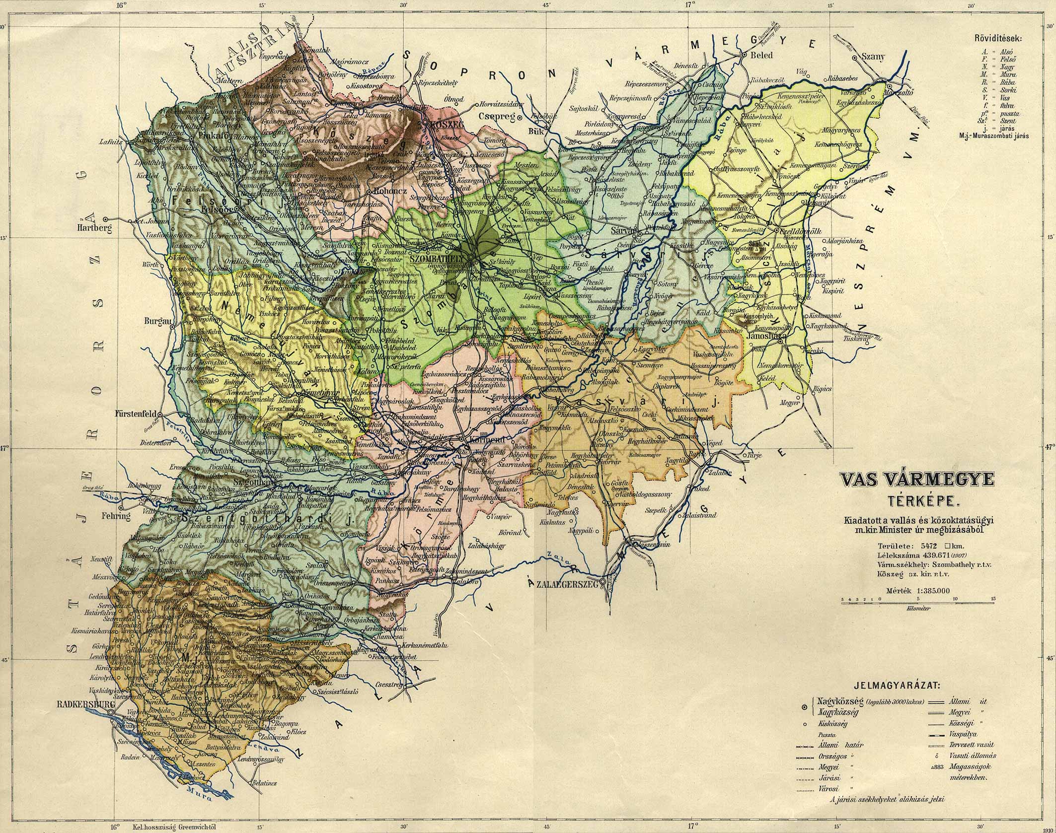
County of Vas in the pre-Trianon Kingdom of Hungary. Komitat Vas w Królestwie Węgier przed traktatem w Trianon. |
||||
| Date | not given | ||||
| Source | http://lazarus.elte.hu/hun/maps/1910/vas.jpg (see county list here) | ||||
| Author | Unknown author | ||||
| Permission (Reusing this file) |
|
||||
File history
Click on a date/time to view the file as it appeared at that time.
| Date/Time | Thumbnail | Dimensions | User | Comment | |
|---|---|---|---|---|---|
| current | 21:30, 10 November 2006 | | 2,126 × 1,678 (739 KB) | PM | {{Information |Description=County of Vas in the pre-Trianon Kingdom of Hungary. <br>Komitat Vas w Królestwie Węgier przed traktatem w Trianon. |Source=hu:Kép:Vas vármegye térképe.jpg uploaded by hu:User:42 |Date=not given |Author=not gi |
File usage
The following pages on the English Wikipedia use this file (pages on other projects are not listed):
Global file usage
The following other wikis use this file:
- Usage on de.wikipedia.org
- Usage on hu.wikipedia.org
- Usage on it.wikipedia.org
- Usage on ro.wikipedia.org
- Usage on sk.wikipedia.org