
File:Wolverhampton - geograph-2642607-by-Roger--Kidd.jpg
Size of this preview: 779 × 600 pixels. Other resolutions: 312 × 240 pixels | 624 × 480 pixels.
Original file (800 × 616 pixels, file size: 294 KB, MIME type: image/jpeg)
| This is a file from the Wikimedia Commons. Information from its description page there is shown below. Commons is a freely licensed media file repository. You can help. |
Summary
| Description |
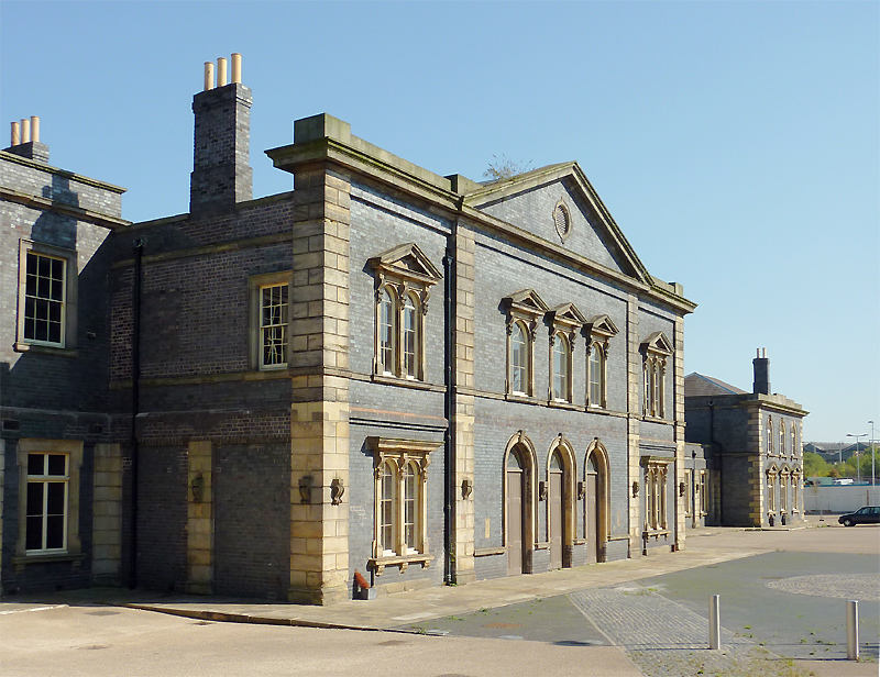
English: Wolverhampton (Low Level) Station The station opened in 1854, and the last passenger services ran in 1972. A long saga of preservation and redevelopment plans for the now Grade II listed station buildings has still yet to be finalised. The latest scheme (October 2011) is for the provision of a banqueting suite (two halls) and conference hall. I think I prefer that to the recently abandoned idea for a £6 million casino. |
| Date | |
| Source | From geograph.org.uk |
| Author | Roger Kidd |
| Permission (Reusing this file) |
Creative Commons Attribution Share-alike license 2.0 |
| Attribution (required by the license) | Roger Kidd / Wolverhampton (Low Level) Station / |
| Camera location | | View this and other nearby images on: OpenStreetMap |
|---|
_region:GB-EAW_heading:90.00&language=en)
| Object location | | View this and other nearby images on: OpenStreetMap |
|---|
_region:GB-EAW_heading:90.00&language=en)
Licensing

|
This image was taken from the Geograph project collection. See this photograph's page on the Geograph website for the photographer's contact details. The copyright on this image is owned by Roger Kidd and is licensed for reuse under the Creative Commons Attribution-ShareAlike 2.0 license.
|
This file is licensed under the Creative Commons Attribution-Share Alike 2.0 Generic license.
Attribution: Roger Kidd
- You are free:
- to share – to copy, distribute and transmit the work
- to remix – to adapt the work
- Under the following conditions:
- attribution – You must give appropriate credit, provide a link to the license, and indicate if changes were made. You may do so in any reasonable manner, but not in any way that suggests the licensor endorses you or your use.
- share alike – If you remix, transform, or build upon the material, you must distribute your contributions under the same or compatible license as the original.
File history
Click on a date/time to view the file as it appeared at that time.
| Date/Time | Thumbnail | Dimensions | User | Comment | |
|---|---|---|---|---|---|
| current | 16:52, 20 December 2020 | | 800 × 616 (294 KB) | Lamberhurst | == {{int:filedesc}} == {{Information |Description={{en|1=<b>Wolverhampton (Low Level) Station</b><br>The station opened in 1854, and the last passenger services ran in 1972. A long saga of preservation and redevelopment plans for the now Grade II listed station buildings has still yet to be finalised. The latest scheme (October 2011) is for the provision of a banqueting suite (two halls) and conference hall. I think I prefer that to the recently abandoned idea for a £6 million casino.}} |Sour... |
File usage
The following pages on the English Wikipedia use this file (pages on other projects are not listed):
Global file usage
The following other wikis use this file:
- Usage on es.wikipedia.org