
Puerto Rico Highway 113
(Redirected from Highway 113 (Puerto Rico))
Highway 113 | ||||
|---|---|---|---|---|
| Ruta 113 | ||||
| Route information | ||||
| Maintained by Puerto Rico DTPW | ||||
| Length | 19.8 km[1][2] (12.3 mi) | |||
| Existed | 1953[3]–present | |||
| Major junctions | ||||
| West end | ||||
| ||||
| East end | ||||
| Location | ||||
| Country | United States | |||
| Territory | Puerto Rico | |||
| Municipalities | Isabela, Quebradillas, Camuy | |||
| Highway system | ||||
| ||||

Puerto Rico Highway 113 (PR-113) is a rural road that travels from Isabela, Puerto Rico to Quebradillas. It begins at downtown Isabela and ends at its intersection with PR-119 near Guajataca Lake.[4][5]
-
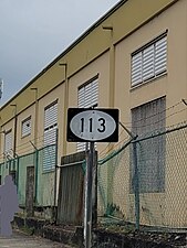 Eastbound sign for PR-113 in Isabela
.jpg)
Major intersections[edit]
| Municipality | Location | km[1][2] | mi | Destinations | Notes |
|---|---|---|---|---|---|
| Isabela | Isabela barrio-pueblo | 0.0 | 0.0 | Western terminus of PR-113; PR-459 access via Calle Juan González | |
| 0.1– 0.2 | 0.062– 0.12 | ||||
| 0.9 | 0.56 | ||||
| 1.1 | 0.68 | ||||
| Guayabos–Mora– Coto tripoint | 2.2 | 1.4 | |||
| Guayabos–Coto line | 4.3 | 2.7 | |||
| Coto | 7.3 105.1[a] | 4.5 65.3 | Western terminus of PR-2 concurrency; right turn only | ||
| Río Guajataca | 104.4[a] | 64.9 | Puente Elvira[6] | ||
| Quebradillas | Terranova | 103.6[a] 7.4 | 64.4 4.6 | Eastern terminus of PR-2 concurrency; right turn only | |
| Quebradillas barrio-pueblo | 10.3– 10.4 | 6.4– 6.5 | One-way street; eastbound access via Calle Ramón Saavedra | ||
| 10.5 | 6.5 | One-way street | |||
| Quebradillas barrio-pueblo–Terranova– Cacao tripoint | 11.3– 11.4 | 7.0– 7.1 | |||
| Cacao–San Antonio line | 13.9 | 8.6 | |||
| San Antonio | 16.0 | 9.9 | |||
| 17.9 | 11.1 | ||||
| Camuy | Piedra Gorda | 19.8 | 12.3 | Eastern terminus of PR-113 | |
| 1.000 mi = 1.609 km; 1.000 km = 0.621 mi | |||||
See also[edit]
References[edit]
- ^ a b Google (9 March 2020). "PR-113 west" (Map). Google Maps. Google. Retrieved 9 March 2020.
- ^ a b Google (9 March 2020). "PR-113 east" (Map). Google Maps. Google. Retrieved 9 March 2020.
- ^ "Quebradillas, Memoria Núm. 62" (PDF). Puerto Rico Planning Board (in Spanish). 1955. Retrieved 4 August 2020.
- ^ National Geographic Maps (2011). Puerto Rico (Map). 1:125,000. Adventure Map (Book 3107). Evergreen, Colorado: National Geographic Maps. ISBN 978-1566955188. OCLC 756511572.
- ^ "Tránsito Promedio Diario (AADT)". Transit Data (Datos de Transito) (in Spanish). DTOP PR. p. 64. Archived from the original on 1 April 2019.
- ^ Luis F. Pumarada O’Neill (1991). "Los Puentes Históricos de Puerto Rico" (PDF) (in Spanish). p. 115. Retrieved 10 March 2020.
External links[edit]
 Media related to Puerto Rico Highway 113 at Wikimedia Commons
This Puerto Rican location article is a stub. You can help Wikipedia by expanding it. |
This Puerto Rico road-related article is a stub. You can help Wikipedia by expanding it. |