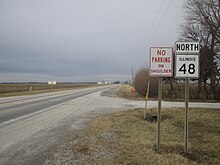
Illinois Route 48
This article needs additional citations for verification. (February 2017) |
IL 48 highlighted in red | ||||
| Route information | ||||
| Maintained by IDOT | ||||
| Length | 85.38 mi[1] (137.41 km) | |||
| Existed | 1924[2]–present | |||
| Major junctions | ||||
| South end | ||||
| North end | ||||
| Location | ||||
| Country | United States | |||
| State | Illinois | |||
| Counties | Montgomery, Christian, Macon, Piatt, DeWitt | |||
| Highway system | ||||
| ||||
Illinois Route 48 (IL 48) is an 85.38-mile (137.41 km) north–south[3] state highway with its southern terminus at Interstate 55 (I-55) and IL 127 in Raymond and its northern terminus at IL 54 east of Clinton.
Route description
[edit]
IL 48 travels southwest to northeast from I-55 to IL 54 east of Clinton. It is an undivided surface street for its entire length. It also serves the cities of Raymond, Taylorville, and Decatur.
IL 48 and IL 127 travel east starting at an interchange with I-55. In Raymond, IL 127 turns south, while IL 48 travels northeast. IL 48 serves Harvel, Morrisonville, Palmer, and Clarksdale. IL 48 then bypasses Hewittsville and downtown Taylorville and intersects with IL 29. Continuing toward Decatur, IL 48 serves Willeys, Stonington, Blue Mound, and Boody. The route has an interchange with US 51 before entering through the city limit of Decatur.
Near downtown Decatur, IL 48 intersects with IL 105 before crossing over the Sangamon River. At the Millikin University, IL 48 indirectly meets US 36. IL 48 then turns east along IL 121. IL 48 turns northeast at a continuous-flow intersection. From there until Cisco, IL 48 parallels I-72. Between two interchanges with I-72 at Decatur and Cisco, the route serves Oreana and Argenta. After Cisco, the route curves north for the remainder of the route, serving Weldon and IL 10. IL 48 eventually ends at IL 54 in Fullerton.[4]
History
[edit]SBI Route 48 traveled from Onarga to Raymond via the current IL 48 and IL 54. The route appeared in 1929 with the construction of a diagonal roadway.[5] Construction of a new road concluded by 1935.[6] The portion from Fullerton to Onarga became part of an extension of US 54 in 1942.[7][8] In 1972, IL 54 was assigned from Springfield to Onarga after US 54 was reverted to its pre-1942 terminus at US 36 (now IL 107) west of Pittsfield.[9][10]
Major intersections
[edit]| County | Location | mi[4] | km | Destinations | Notes |
|---|---|---|---|---|---|
| Montgomery | | Continuation beyond IL 48 to Historic US 66 | |||
| 0.0 | 0.0 | Southern terminus; south end of IL 127 concurrency; I-55 exit 63 | |||
| Raymond | 3.5 | 5.6 | North end of IL 127 concurrency | ||
| Christian | Taylorville | 26.7 | 43.0 | ||
| Macon | | 49.0 | 78.9 | Interchange | |
| Decatur | 51.4 | 82.7 | Western terminus of IL 105 | ||
| 53.0 | 85.3 | ||||
| 55.1 | 88.7 | South end of IL 121 concurrency | |||
| 57.7 | 92.9 | North end of IL 121 concurrency | |||
| | 60.5 | 97.4 | I-72 exit 144 | ||
| Macon–Piatt county line | | 71.6 | 115.2 | Northern terminus of IL 32 | |
| | 72.0 | 115.9 | I-72 exit 156 | ||
| De Witt | Weldon | 79.7 | 128.3 | ||
| | 85.38 | 137.41 | Northern terminus | ||
1.000 mi = 1.609 km; 1.000 km = 0.621 mi
| |||||
See also
[edit]References
[edit]- ^ Illinois Technology Transfer Center (2006). "T2 GIS Data". Retrieved 2007-11-08.
- ^ Carlson, Rich (March 15, 2005). "Illinois Highways Page: Routes 41 thru 60". Retrieved April 7, 2006.
- ^ "Route 48". Illinois Highways Ends. Archived from the original on October 5, 2012. Retrieved April 7, 2006.
- ^ a b "Overview map of IL 48" (Map). Google Maps. Retrieved December 10, 2022.
- ^ Illinois Secretary of State; H.M. Gousha (1929). Illinois Official Auto Road Map (Map). [c. 1:950,000 and c. 1:1,110,000]. Springfield: Illinois Secretary of State. Retrieved December 10, 2022 – via Illinois Digital Archives.
- ^ Illinois Secretary of State; H.M. Gousha (1935). Official Road Map Illinois (Map). [c. 1:950,000 and c. 1:1,110,000]. Springfield: Illinois Secretary of State. Retrieved December 10, 2022 – via Illinois Digital Archives.
- ^ Illinois Secretary of State; Rand McNally (1942). Illinois Road Map (Map). c. 1:918,720. Springfield: Illinois Secretary of State. Retrieved December 10, 2022 – via Illinois Digital Archives.
- ^ Executive Committee (June 3, 1940). "Addenda to Minutes of Executive Committee" (PDF) (Report). Washington, DC: American Association of State Highway Officials. Retrieved December 10, 2022 – via Wikimedia Commons.
- ^ Illinois Department of Transportation (1972). Illinois Official Highway Map (Map). [1:772,500]. Springfield: Illinois Department of Transportation. Retrieved December 10, 2022 – via Illinois Digital Archives.
- ^ U.S. Route Numbering Subcommittee (June 21, 1971). "U.S. Route Numbering Subcommittee Agenda Showing Action Taken by the Executive Committee" (PDF) (Report). Washington, DC: American Association of State Highway Officials. Retrieved December 10, 2022 – via Wikimedia Commons.
External links
[edit]![]() Media related to Illinois Route 48 at Wikimedia Commons
Media related to Illinois Route 48 at Wikimedia Commons


