List of islands of the Channel Islands
Appearance
(Redirected from List of islands of Guernsey)
This is a list of islands within the Channel Islands in the English Channel off the coast of Normandy. This group of islands the Bailiwick of Guernsey, the Bailiwick of Jersey and Chausey.
Inhabited islands
[edit]| Name | Image | Coordinates | Population | Area (hectares) | Elevation (metres) |
|---|---|---|---|---|---|
| Alderney |  | 49°42′52″N 2°12′19″W | 2020 (Jan 2016) | 780[a] | 90 |
| Sark |  | 49°25′59″N 2°21′39″W | 600 (2002) | 550[b] | 114[1] |
| Herm |  | 49°28′21″N 2°26′57″W | 60 (2002) | 200[c] | 66[2] |
| Guernsey |  | 49°27′21″N 2°34′39″W | 63276 (2019) | 6,340[d] | 110[3] |
| Jersey |  | 49°12′36″N 2°9′0″W | 105500[4][5][6] (Dec 2017) | 11,820[e] | 143 |
| Grande-Île |  | 48°52′20″N 1°49′50″W | 30 | 45 | 31 |
Islands in the Bailiwick of Guernsey
[edit]As well as the island of Guernsey itself, it also includes:[7]
| Name | Image | Coordinates | Area |
|---|---|---|---|
| Burhou[8] |  | 49°43′48″N 2°15′6″W | 13[f] |
| Ortac | 49°43′23″N 2°17′26″W | ||
| Les Casquets |  | 49°43′4″N 2°22′7″W | |
| Houmet des Pies | 49°43′53″N 2°10′57″W[9] | ||
| Raz Island[10] | 49°43′6″N 2°10′3″W | ||
| L'Etac de la Quoiré[11] | 49°42′21″N 2°11′26″W[9] | ||
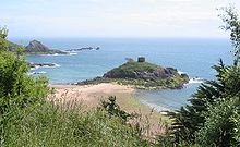
| Fort Clonque[12] |  | 49°42′50″N 2°13′59″W |
- Brecqhou[8]
- Le Nesté
- Les Burons [13]
- Baleine
- Moie de Pot
- Moie de Breniere [8]
- Moie de Port Gorey
- Moie de la Bretagne
- Moie de la Fontaine
- Moie de Gouliot
- Moie de Mouton
- Tintageu
- Les Autelets [14]
- Le Grand Autelet
- L'Épile
- Le Blanc Autelet (Le Petit Autelet)
- Bec du Nez (Oystercatcher's Rock)
- La Petite Moie[8]
- La Grande Moie[8]
- L'Etac [8]
- La Noire Pute

| Name | Image | Coordinates | Area (ha) |
|---|---|---|---|
| Caquorobert |  | 49°28′0″N 2°27′0″W | |
| Jethou[8] |  | 49°27′30″N 2°27′45″W | 18[g] |
| Crevichon[8] |  | 49°27′56″N 2°27′53″W | 3.0[h] |
| Grande Fauconnière[8] | 49°27′0″N 2°28′0″W[9] | ||
| Goubinuere | 49°27′0″N 2°27′0″W[9] |
- Lihou[8]
- Lihoumel
- Les Houmets
- Bréhon

View of the lighthouse and Les Hanois reef - Les Hanois[7] (see also Les Hanois Lighthouse)
- Le Bisé
- Le Grand Hanois
- Le Petit Hanois
- La Percée
- Round Rock
- La Grosse Rocque
- Les Tas de Pois d'Amont[15]
- Les Tas de Pois d'Aval
- La Grosse Rocque[16]
- La Platte Fougère[17]
- La Conchée[18]
Islands in the Bailiwick of Jersey
[edit]


As well as the island of Jersey itself, the Bailiwick includes[7] the nearly uninhabited islands and islets of:
- Les Minquiers[19]
- Maîtresse Île / Maîtr' Île
- Les Maisons
- Le Niêsant
- Les Faucheurs
- La Haute Grune
- Les Écréhous[20]
- Maîtr'Île
- La Marmotchiéthe
- Lé Bliantch'Île
- Les D'mies
- La Grand' Naithe
- L'Êtchièrviéthe
- Lé Fou
- La Froutchie
- Les Dirouilles
- Les Pierres de Lecq[21]
- L'Êtchièrviéthe
- La Rocque du Nord
- L'Êtaîse or L'Êtaîthe
- Lé Bel
- Lé Longis
- La P'tite Mathe
- La Grôsse (Great Rock)
- La Grand' Mathe
- La Greune dé Lé, or La Bonnette
- La Greune du Seur-Vouêt
- L'Orange
- La Vouêtaîse, La Vouêtaîthe, or La Vouêt'rêsse
- La Cappe
- La Douoche
- Lé Byi
- La Rocque Mollet
- L'Êtché au Nord-Vouêt
- La Galette
- La Briarde
- La Sprague
- La Niêthole Jean Jean or Lé Gouoillot
- Île Agois
- La Motte (Green Island), a tidal island
- L'Islet, site of Elizabeth Castle
- L'Île au Guerdain, site of Janvrin's Tomb
- Icho, site of Icho Tower
- L'Avarison, site of Seymour Tower
- La Rocque Ho
- La Grosse Tête
- Les Caînes[22]
- Le Grand Caramé[22]
- Le Petit Caramé[22]
- Le Fara[22]
- Les Rotchettes[22]
- L'Île au Prêtre[22]
- Le Cormoran[22]
- Le Cheval Guillaume[22]
- Lé Long Êtchet
- L'Étacquerel[22]
- La Froutchie
- L'Île Pèrchie
- Hèrquantîn
- other unnamed rocks and reefs
Calling the above-named entities "Islands" is a very generous representation. Most are no more than uninhabitable rocks jutting out of the sea. Les Écréhous are habitable; the rest would require a hardy individual to even attempt habitation.
Notes
[edit]- ^ Value calculated by converting 7.8 km2 into ha.
- ^ Value calculated by converting 5.5 km2 into ha.
- ^ Value calculated by converting 2 km2 into ha.
- ^ Value calculated by converting 63.4 km2 into ha.
- ^ Value calculated by converting 118.2 km2 into ha.
- ^ Value calculated by converting 0.13 km2 into ha.
- ^ Value calculated by converting 44 acres into ha.
- ^ Value calculated by converting 0.03 km2 into ha.
References
[edit]- ^ "Island Life".
- ^ "Hill Bagging".
- ^ "Topographic maps".
- ^ http://www.gov.je/Government/JerseyInFigures/Population/Pages/Population.aspx
- ^ "Population Estimate Current" (PDF).
- ^ "Total population, annual change, natural growth, net migration per year".
- ^ a b c Coysh, Victor (1985). Channel Islets. Guernsey: Guernsey Press. ISBN 0902550128.
- ^ a b c d e f g h i j "Gull Breeding Sites in the Bailiwick of Guernsey". Archived from the original on 4 March 2016. Retrieved 4 November 2015.
- ^ a b c d Geographic Names Server, Wikidata Q1194038
- ^ "Fort Ile de Raz". Visit Alderney. Archived from the original on 18 July 2024. Retrieved 4 November 2015.
- ^ "Region 8. Longis Bay and Essex Hill to Bluestone Bay;". Flora.org.gg. Archived from the original on 18 July 2024. Retrieved 4 November 2015.
- ^ "Fort Clonque". The Landmark Trust. Archived from the original on 18 July 2024. Retrieved 4 November 2015.
- ^ "Les Burons, Sark". Archived from the original on 18 July 2024. Retrieved 4 November 2015.
- ^ "Les Autelets, Sark". Archived from the original on 18 July 2024. Retrieved 2 May 2019.
- ^ "Moulin Huet Bay, Guernsey about 1883, Pierre-Auguste Renoir".
- ^ "2009 Liberation Grosse Rocque flag raised". BBC. Archived from the original on 18 July 2024. Retrieved 23 December 2019.
- ^ "Flashy Concrete Repair". Archived from the original on 13 October 2015. Retrieved 4 November 2015.
- ^ "MV Prosperity Memorial". BBC. Archived from the original on 18 July 2024. Retrieved 23 December 2019.
- ^ "Les Minquiers, Jersey". Ramsar.
- ^ "Les Écrehous & Les Dirouilles, Jersey". Ramsar.
- ^ "Les Pierres de Lecq". Ramsar.
- ^ a b c d e f g h i Stevens, Arthur & Stevens (1986). Jersey Place Names. Jersey. ISBN 0-901897-17-5.
{{cite book}}: CS1 maint: location missing publisher (link)

