[ 3] Name on the Register[ 4]
Image
Date listed[ 5]
Location
City or town
Description
1
Abbott Tract Historic District Abbott Tract Historic District July 21, 1983 (#83001438 ) Roughly bounded by Matanzas Bay and Pine, San Marco, and Shenandoah Aves. 29°54′04″N 81°18′50″W / 29.901111°N 81.313889°W / 29.901111; -81.313889 (Abbott Tract Historic District ) St. Augustine
2
Alcazar Hotel Alcazar Hotel February 24, 1971 (#71001013 ) 79 King St. 29°53′30″N 81°18′51″W / 29.891667°N 81.314167°W / 29.891667; -81.314167 (Alcazar Hotel ) St. Augustine
3
Avero House Avero House June 13, 1972 (#72001459 ) 39 St. George St. 29°58′44″N 81°18′48″W / 29.978889°N 81.313333°W / 29.978889; -81.313333 (Avero House ) St. Augustine
4
Bridge of Lions Bridge of Lions November 19, 1982 (#82001040 ) King St. 29°53′33″N 81°18′27″W / 29.8925°N 81.3075°W / 29.8925; -81.3075 (Bridge of Lions ) St. Augustine
5
Castillo de San Marcos National Monument Castillo de San Marcos National Monument October 15, 1966 (#66000062 ) 1 Castillo Dr. 29°53′52″N 81°18′41″W / 29.897778°N 81.311389°W / 29.897778; -81.311389 (Castillo de San Marcos National Monument ) St. Augustine A National Monument
6
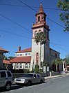
Cathedral of St. Augustine Cathedral of St. Augustine April 15, 1970 (#70000844 ) Cathedral St. between Charlotte and St. George Sts. 29°53′34″N 81°18′45″W / 29.892778°N 81.3125°W / 29.892778; -81.3125 (Cathedral of St. Augustine ) St. Augustine
7
City of St. Augustine Miniature Golf Course City of St. Augustine Miniature Golf Course November 19, 2014 (#14000953 ) 111 Avenida Menendez 29°53′30″N 81°18′37″W / 29.8915626°N 81.3102826°W / 29.8915626; -81.3102826 (City of St. Augustine Miniature Golf Course ) St. Augustine
8
Constitution Obelisk Constitution Obelisk December 18, 2012 (#12000364 ) Plaza de la Constitution 29°53′33″N 81°18′45″W / 29.89245°N 81.312577°W / 29.89245; -81.312577 (Constitution Obelisk ) St. Augustine
9
Dixie Highway-Hastings, Espanola and Bunnell Road Dixie Highway-Hastings, Espanola and Bunnell Road April 20, 2005 (#05000311 ) Roughly Espanola in Flagler County to County Route 204 in St. Johns County 29°34′49″N 81°20′35″W / 29.580278°N 81.343056°W / 29.580278; -81.343056 (Dixie Highway-Hastings, Espanola and Bunnell Road ) Espanola Extends into Flagler County
10
Fish Island Site Upload image June 13, 1972 (#72001460 ) Address Restricted St. Augustine
11
Fort Matanzas National Monument Fort Matanzas National Monument October 15, 1966 (#66000098 ) 15 miles south of St. Augustine 29°42′55″N 81°14′21″W / 29.715278°N 81.239167°W / 29.715278; -81.239167 (Fort Matanzas National Monument ) St. Augustine A National Monument
12
Fort Matanzas National Monument Headquarters and Visitor Center Fort Matanzas National Monument Headquarters and Visitor Center December 31, 2008 (#08001245 ) 8635 State Road A1A , South 29°42′42″N 81°14′07″W / 29.711667°N 81.235278°W / 29.711667; -81.235278 (Fort Matanzas National Monument Headquarters and Visitor Center ) St. Augustine
13
Fountain of Youth Archeological Park Fountain of Youth Archeological Park June 13, 2016 (#16000361 ) 11 Magnolia Ave. 29°54′26″N 81°18′58″W / 29.907306°N 81.316139°W / 29.907306; -81.316139 (Fountain of Youth Archeological Park ) St. Augustine
14
Fullerwood Park Residential Historic District Fullerwood Park Residential Historic District September 24, 2010 (#10000767 ) Roughly bounded by San Marcos, Macaris, Hildreth & Hospital Creek 29°54′59″N 81°19′14″W / 29.916389°N 81.320556°W / 29.916389; -81.320556 (Fullerwood Park Residential Historic District ) St. Augustine
15
Gonzalez-Alvarez House Gonzalez-Alvarez House April 15, 1970 (#70000845 ) 14 St. Francis St. 29°53′17″N 81°18′36″W / 29.888056°N 81.31°W / 29.888056; -81.31 (Gonzalez-Alvarez House ) St. Augustine US National Historic Landmark
16
Government House Government House January 7, 2014 (#13000812 ) 48 King St. 29°53′32″N 81°18′47″W / 29.892355°N 81.313076°W / 29.892355; -81.313076 (Government House ) St. Augustine part of the Florida's New Deal Resources MPS
17
Grace United Methodist Church Grace United Methodist Church November 29, 1979 (#79003132 ) 8 Carrera St. 29°53′42″N 81°18′54″W / 29.895090°N 81.314947°W / 29.895090; -81.314947 (Grace United Methodist Church ) St. Augustine
18
Hastings High School Hastings High School June 14, 2006 (#06000502 ) 6195 S. Main St. 29°42′40″N 81°30′18″W / 29.711111°N 81.505°W / 29.711111; -81.505 (Hastings High School ) Hastings
19
Hotel Ponce De Leon Hotel Ponce De Leon May 6, 1975 (#75002067 ) 74 King St., bounded by King, Valencia, Sevilla, and Cordova Sts. 29°53′32″N 81°18′54″W / 29.892222°N 81.315°W / 29.892222; -81.315 (Hotel Ponce De Leon ) St. Augustine US National Historic Landmark
20
Lincolnville Historic District Lincolnville Historic District November 29, 1991 (#91000979 ) Bounded by Cedar, Riberia, Cerro, and Washington Sts. and DeSoto Pl. 29°53′05″N 81°18′52″W / 29.884722°N 81.314444°W / 29.884722; -81.314444 (Lincolnville Historic District ) St. Augustine
21
Lindsley House Lindsley House September 10, 1971 (#71001014 ) 214 St. George St. 29°53′30″N 81°18′48″W / 29.891667°N 81.313333°W / 29.891667; -81.313333 (Lindsley House ) St. Augustine
22
Llambias House Llambias House April 15, 1970 (#70000846 ) 31 St. Francis St. 29°53′15″N 81°18′39″W / 29.8875°N 81.310833°W / 29.8875; -81.310833 (Llambias House ) St. Augustine
23
Lodge and Hut Upload image March 20, 2024 (#100010155 ) 9177-9179 Old A1A Highway 29°41′50″N 81°13′23″W / 29.6971°N 81.2231°W / 29.6971; -81.2231 (Lodge and Hut ) Summer Haven
24
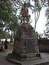
Father Francisco Lopez Statue Father Francisco Lopez Statue June 5, 2012 (#12000317 ) 27 Ocean Avenue 29°54′15″N 81°19′00″W / 29.904204°N 81.316724°W / 29.904204; -81.316724 (Father Francisco Lopez Statue ) St. Augustine
25
Xavier Lopez House Xavier Lopez House July 1, 1993 (#93000579 ) 93½ King St. 29°53′29″N 81°18′58″W / 29.891389°N 81.316111°W / 29.891389; -81.316111 (Xavier Lopez House ) St. Augustine
26
Markland Markland December 6, 1978 (#78003080 ) 102 King St. 29°53′31″N 81°19′02″W / 29.891944°N 81.317222°W / 29.891944; -81.317222 (Markland ) St. Augustine
27
Menendez Encampment Site Menendez Encampment Site September 27, 2016 (#16000295 ) 21 Magnolia Ave. 29°54′27″N 81°18′59″W / 29.907574°N 81.316345°W / 29.907574; -81.316345 (Menendez Encampment Site ) St. Augustine On the grounds of the Fountain of Youth Archaeological Park .
28
Arthur Milam House Arthur Milam House June 7, 2016 (#16000323 ) 1033 Ponte Vedra Blvd. 30°10′26″N 81°21′34″W / 30.17385°N 81.35935°W / 30.17385; -81.35935 (Arthur Milam House ) Ponte Vedra Beach
29
Model Land Company Historic District Model Land Company Historic District August 2, 1983 (#83001439 ) Roughly bounded by Ponce de Leon Boulevard and King, Cordova, and Orange Sts. 29°53′39″N 81°19′06″W / 29.894167°N 81.318333°W / 29.894167; -81.318333 (Model Land Company Historic District ) St. Augustine
30
Moultrie Church Moultrie Church September 8, 2014 (#14000553 ) 480 Wildwood Dr. 29°48′55″N 81°20′10″W / 29.81516°N 81.33605°W / 29.81516; -81.33605 (Moultrie Church ) St. Augustine
31
Nelmar Terrace Historic District Nelmar Terrace Historic District March 28, 2011 (#11000145 ) Alfred St., San Carlos Ave., San Marcos Ave., Hospital Creek 29°54′39″N 81°19′06″W / 29.910833°N 81.318333°W / 29.910833; -81.318333 (Nelmar Terrace Historic District ) St. Augustine
32
North City Historic District North City Historic District October 1, 2009 (#09000778 ) Roughly bounded by Castillo Drive , San Marcos Avenue, Old Mission Avenue, and U.S. Route 1 29°54′07″N 81°19′05″W / 29.901944°N 81.318056°W / 29.901944; -81.318056 (North City Historic District ) St. Augustine
33
Henry S. O'Brien Estate Upload image October 24, 2024 (#100010928 ) 99 Kelley Lane 29°49′27″N 81°18′08″W / 29.824156°N 81.302235°W / 29.824156; -81.302235 (Henry S. O'Brien Estate ) St. Augustine
34
O'Reilly House O'Reilly House October 15, 1974 (#74002192 ) 131 Aviles St. 29°53′24″N 81°18′41″W / 29.89°N 81.311389°W / 29.89; -81.311389 (O'Reilly House ) St. Augustine
35
Old St. Johns County Jail Old St. Johns County Jail August 27, 1987 (#87001427 ) 167 San Marco Ave. 29°54′28″N 81°19′08″W / 29.907778°N 81.318889°W / 29.907778; -81.318889 (Old St. Johns County Jail ) St. Augustine
36
Record Building Record Building April 26, 2006 (#06000315 ) 154 Cordova St. 29°53′20″N 81°18′47″W / 29.888889°N 81.313056°W / 29.888889; -81.313056 (Record Building ) St. Augustine
37
Rodriguez-Avero-Sanchez House Rodriguez-Avero-Sanchez House April 16, 1971 (#71001015 ) 52 St. George St. 29°53′46″N 81°18′49″W / 29.896111°N 81.313611°W / 29.896111; -81.313611 (Rodriguez-Avero-Sanchez House ) St. Augustine
38
St. Augustine Alligator Farm Historic District St. Augustine Alligator Farm Historic District September 10, 1992 (#92001232 ) 999 Anastasia Boulevard 29°52′53″N 81°17′18″W / 29.881389°N 81.288333°W / 29.881389; -81.288333 (St. Augustine Alligator Farm Historic District ) St. Augustine
39
St. Augustine Beach Hotel and Beachfront St. Augustine Beach Hotel and Beachfront January 11, 2022 (#100007284 ) 370 FL A1A 29°51′24″N 81°15′57″W / 29.856539°N 81.265774°W / 29.856539; -81.265774 (St. Augustine Beach Hotel and Beachfront ) St. Augustine Beach
40
St. Augustine Civic Center St. Augustine Civic Center April 21, 2005 (#05000316 ) 10 Castillo Dr. 29°53′55″N 81°18′53″W / 29.898611°N 81.314722°W / 29.898611; -81.314722 (St. Augustine Civic Center ) St. Augustine Part of the Florida's New Deal Resources MPS
41
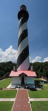
St. Augustine Lighthouse and Keeper's Quarters St. Augustine Lighthouse and Keeper's Quarters March 19, 1981 (#81000668 ) Old Beach Rd. 29°53′08″N 81°17′19″W / 29.88543°N 81.28852°W / 29.88543; -81.28852 (St. Augustine Lighthouse and Keeper's Quarters ) St. Augustine
42
St. Augustine National Cemetery St. Augustine National Cemetery May 16, 2016 (#16000271 ) 104 Marine St. 29°53′11″N 81°18′34″W / 29.886361°N 81.309572°W / 29.886361; -81.309572 (St. Augustine National Cemetery ) St. Augustine
43
St. Augustine Public Burying Ground St. Augustine Public Burying Ground July 23, 2021 (#100006756 ) South Castillo Dr. 29°53′54″N 81°18′50″W / 29.898317°N 81.313917°W / 29.898317; -81.313917 (St. Augustine Public Burying Ground ) St. Augustine
44
St. Augustine Town Plan Historic District St. Augustine Town Plan Historic District April 15, 1970 (#70000847 ) Roughly bounded by Grove Ave., the Matanzas River , and South and Washington Sts. 29°53′36″N 81°18′38″W / 29.893333°N 81.310556°W / 29.893333; -81.310556 (St. Augustine Town Plan Historic District ) St. Augustine
45
St. Augustine Water Works St. Augustine Water Works February 5, 2014 (#13001134 ) 184 San Marco Ave. 29°54′38″N 81°19′14″W / 29.9104493°N 81.3206737°W / 29.9104493; -81.3206737 (St. Augustine Water Works ) St. Augustine
46
Sanchez Homestead Sanchez Homestead October 12, 2001 (#01001083 ) 7270 Old State Road 207 29°44′16″N 81°28′43″W / 29.737778°N 81.478611°W / 29.737778; -81.478611 (Sanchez Homestead ) Elkton
47
Sanchez Powder House Site Sanchez Powder House Site April 14, 1972 (#72001461 ) Marine St. 29°52′53″N 81°18′29″W / 29.881389°N 81.308056°W / 29.881389; -81.308056 (Sanchez Powder House Site ) St. Augustine
48
Second Fort Mose Site Second Fort Mose Site October 12, 1994 (#94001645 ) Address Restricted 29°55′40″N 81°19′31″W / 29.927778°N 81.325278°W / 29.927778; -81.325278 (Second Fort Mose Site ) St. Augustine First free African settlement in the United States[ 6]
49
Shell Bluff Landing (8SJ32) Upload image April 25, 1991 (#91000455 ) Address Restricted Ponte Vedra Beach
50
Solla-Carcaba Cigar Factory Solla-Carcaba Cigar Factory May 6, 1993 (#93000374 ) 88 Riberia St. 29°53′27″N 81°19′08″W / 29.890833°N 81.318889°W / 29.890833; -81.318889 (Solla-Carcaba Cigar Factory ) St. Augustine
51
Spanish Coquina Quarries Spanish Coquina Quarries February 23, 1972 (#72001462 ) State Road A1A in Anastasia State Park 29°52′14″N 81°16′31″W / 29.870556°N 81.275278°W / 29.870556; -81.275278 (Spanish Coquina Quarries ) St. Augustine Beach
52
Stanbury Cottage Stanbury Cottage October 8, 2008 (#08000966 ) 232 St. George Street 29°53′27″N 81°18′44″W / 29.8907°N 81.31235°W / 29.8907; -81.31235 (Stanbury Cottage ) St. Augustine
53
Storm Wreck Upload image October 2, 2017 (#100001671 ) Address Restricted St. Augustine vicinity
54
Villa Zorayda Villa Zorayda September 23, 1993 (#93001002 ) 83 King St. 29°53′27″N 81°18′53″W / 29.890833°N 81.314722°W / 29.890833; -81.314722 (Villa Zorayda ) St. Augustine
55
Horace Walker House Horace Walker House January 30, 1998 (#98000026 ) 33 Old Mission Ave. 29°54′12″N 81°19′14″W / 29.903333°N 81.320556°W / 29.903333; -81.320556 (Horace Walker House ) St. Augustine
56
Ximenez-Fatio House Ximenez-Fatio House July 25, 1973 (#73002135 ) 20 Aviles St. 29°53′28″N 81°18′41″W / 29.89102°N 81.31152°W / 29.89102; -81.31152 (Ximenez-Fatio House ) St. Augustine


