From Wikipedia, the free encyclopedia
Location of Stafford County in Virginia This is a list of the National Register of Historic Places listings in Stafford County, Virginia .
This is intended to be a complete list of the properties and districts on the National Register of Historic Places in Stafford County , Virginia , United States . The locations of National Register properties and districts for which the latitude and longitude coordinates are included below, may be seen in an online map.[ 1]
There are 21 properties and districts listed on the National Register in the county, including 3 National Historic Landmarks .
This National Park Service list is complete through NPS recent listings posted November 8, 2024. [ 2]
[ 3] Name on the Register[ 4]
Image
Date listed[ 5]
Location
City or town
Description
1
Accokeek Furnace Archeological Site (44ST53) Upload image May 15, 1984 (#84003598 ) Address Restricted Stafford
2
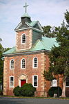
Aquia Church Aquia Church November 12, 1969 (#69000282 ) North of the junction of U.S. Route 1 and Garrisonville Rd. 38°27′53″N 77°24′11″W / 38.464722°N 77.403056°W / 38.464722; -77.403056 (Aquia Church ) Garrisonville
3
Belmont Belmont October 15, 1966 (#66000848 ) Off U.S. Route 1 38°19′26″N 77°28′23″W / 38.323889°N 77.473056°W / 38.323889; -77.473056 (Belmont ) Falmouth Also known as Gari Melchers Home
4
Bethlehem Primitive Baptist Church Cemetery Bethlehem Primitive Baptist Church Cemetery June 21, 2018 (#100002206 ) 135 Chapel Green Rd. 38°17′37″N 77°21′25″W / 38.293611°N 77.356972°W / 38.293611; -77.356972 (Bethlehem Primitive Baptist Church Cemetery ) Fredericksburg
5
Carlton Carlton October 3, 1973 (#73002064 ) 501 Melchers Dr. 38°19′32″N 77°28′14″W / 38.325556°N 77.470556°W / 38.325556; -77.470556 (Carlton ) Falmouth
6
Clearview Clearview February 24, 1975 (#75002039 ) Off Telegraph Rd. near U.S. Route 1 and Butler Rd. 38°19′25″N 77°27′49″W / 38.323750°N 77.463611°W / 38.323750; -77.463611 (Clearview ) Falmouth
7
Conway House Conway House March 8, 2004 (#04000162 ) 305 King St. 38°19′19″N 77°28′07″W / 38.321806°N 77.468611°W / 38.321806; -77.468611 (Conway House ) Falmouth
8
Falmouth Historic District Falmouth Historic District February 26, 1970 (#70000825 ) Junction of U.S. Routes 1 and 17 38°19′28″N 77°28′00″W / 38.324444°N 77.466667°W / 38.324444; -77.466667 (Falmouth Historic District ) Falmouth
9
Ferry Farm Site Ferry Farm Site May 5, 1972 (#72001417 ) East of Fredericksburg at 712 Kings Highway 38°17′36″N 77°26′55″W / 38.293333°N 77.448611°W / 38.293333; -77.448611 (Ferry Farm Site ) Fredericksburg Same as George Washington Boyhood Home Site
10
Hartwood Manor Hartwood Manor February 1, 2006 (#05001618 ) 335 Hartwood Rd. 38°25′15″N 77°34′26″W / 38.420833°N 77.573750°W / 38.420833; -77.573750 (Hartwood Manor ) Hartwood
11
Hartwood Presbyterian Church Hartwood Presbyterian Church November 13, 1989 (#89001929 ) Junction of Hartwood and Hartwood Church Rds. 38°24′07″N 77°34′01″W / 38.401944°N 77.567083°W / 38.401944; -77.567083 (Hartwood Presbyterian Church ) Hartwood
12
Hunter's Ironworks Hunter's Ironworks January 18, 1974 (#74002147 ) West of Falmouth off U.S. Route 17 38°19′27″N 77°29′14″W / 38.324167°N 77.487222°W / 38.324167; -77.487222 (Hunter's Ironworks ) Falmouth
13
Quantico Marine Corps Base Historic District Quantico Marine Corps Base Historic District March 26, 2001 (#01000260 ) Marine Corps Base Quantico 38°30′08″N 77°18′21″W / 38.502222°N 77.305833°W / 38.502222; -77.305833 (Quantico Marine Corps Base Historic District ) Quantico Extends into Prince William County
14
Potomac Creek Site Potomac Creek Site December 3, 1969 (#69000281 ) Indian Point Rd.[ 6] 38°21′06″N 77°17′53″W / 38.351667°N 77.298056°W / 38.351667; -77.298056 (Potomac Creek Site ) Brooke
15
Public Quarry at Government Island Public Quarry at Government Island May 30, 2007 (#03000457 ) Address Restricted 38°26′54″N 77°23′00″W / 38.448333°N 77.383333°W / 38.448333; -77.383333 (Public Quarry at Government Island ) Stafford
16
Redoubt No. 2 Redoubt No. 2 February 14, 2006 (#06000051 ) Old Fort Lane 38°23′36″N 77°21′21″W / 38.393317°N 77.355817°W / 38.393317; -77.355817 (Redoubt No. 2 ) Stafford
17
Stafford Training School Stafford Training School February 5, 2013 (#12001272 ) 1739 U.S. Route 1 38°24′16″N 77°25′12″W / 38.404444°N 77.420000°W / 38.404444; -77.420000 (Stafford Training School ) Stafford
18
Tennessee Camp Upload image November 12, 2008 (#08001059 ) Civil War and Hill trails[ 7] 38°29′45″N 77°19′52″W / 38.495806°N 77.331111°W / 38.495806; -77.331111 (Tennessee Camp ) Marine Corps Base Quantico
19
Union Church and Cemetery Union Church and Cemetery September 10, 2008 (#08000896 ) Carter St. and Butler Rd. 38°19′23″N 77°27′56″W / 38.323056°N 77.465556°W / 38.323056; -77.465556 (Union Church and Cemetery ) Falmouth
20
George Washington Boyhood Home Site George Washington Boyhood Home Site February 16, 2000 (#00000259 ) 237 King's Highway 38°17′38″N 77°26′53″W / 38.293889°N 77.448056°W / 38.293889; -77.448056 (George Washington Boyhood Home Site ) Fredericksburg
21
White Oak Church White Oak Church January 3, 1991 (#90002112 ) 8 Caisson Rd. 38°18′01″N 77°22′32″W / 38.300278°N 77.375694°W / 38.300278; -77.375694 (White Oak Church ) Falmouth
^ The latitude and longitude information provided in this table was derived originally from the National Register Information System, which has been found to be fairly accurate for about 99% of listings. Some locations in this table may have been corrected to current GPS standards.
^ National Park Service, United States Department of the Interior , "National Register of Historic Places: Weekly List Actions" , retrieved November 8, 2024.
^ Numbers represent an alphabetical ordering by significant words. Various colorings, defined here , differentiate National Historic Landmarks and historic districts from other NRHP buildings, structures, sites or objects.
^ "National Register Information System" . National Register of Historic Places National Park Service . April 24, 2008.^ The eight-digit number below each date is the number assigned to each location in the National Register Information System database, which can be viewed by clicking the number.
^ Stewart, T. Dale. Archeological exploration of Patawomeke : the Indian town site (44St2) ancestral to the one (44St1) visited in 1608 by Captain John Smith . Smithsonian contributions to anthropology 36. Washington: Smithsonian 1992, ix.
^ Haynes, John H. National Register of Historic Places Inventory/Nomination: Tennessee Camp . National Park Service , 2005-07-22, 14.
Lists Lists Other lists
CDPs Map of Virginia highlighting Stafford County Unincorporated Footnotes ‡This populated place also has portions in an adjacent county or counties


