Rostamkhan
Appearance
(Redirected from RostamKhan)
Rostamkhan (Kapneh Karan)
Persian: رستمخان (کپنه کران) | |
|---|---|
Village | |
 The village of Rostamkhan | |
| Coordinates: 33°53′59″N 46°10′12″E / 33.89972°N 46.17000°E[1] | |
| Country | Iran |
| Province | Ilam |
| County | Eyvan |
| District | Zarneh |
| Rural District | Kalan |
| Area | |
| • Total | 10 ha (20 acres) |
| Elevation | 1,040 m (3,410 ft) |
| Population (2016)[2] | |
| • Total | 558 |
| • Density | 5,600/km2 (14,000/sq mi) |
| Time zone | UTC+03:30 (IRST) |
| Geocode | 6236 |
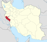
Rostamkhan (Kapneh Karan) (Persian: رستمخان (کپنه کران))[a] is a village in Kalan Rural District of Zarneh District, Eyvan County, Ilam province, Iran.
Demographics
[edit]Language and ethnicity
[edit]The village is populated by Kurds.[4] The language of the people of this village is Kalhori Kurdish.[citation needed]
Population
[edit]At the time of the 2006 National Census, the village's population was 663 in 121 households.[5] The following census in 2011 counted 625 people in 137 households.[6] The 2016 census measured the population of the village as 558 people in 138 households. It was the most populous village in its rural district.[2]
See also
[edit]Notes
[edit]References
[edit]- ^ OpenStreetMap contributors (6 June 2023). "Kapneh Karan, Eyvan County" (Map). OpenStreetMap. Retrieved 6 June 2023.
- ^ a b "Census of the Islamic Republic of Iran, 1395 (2016)". AMAR (in Persian). The Statistical Center of Iran. p. 16. Archived from the original (Excel) on 1 November 2020. Retrieved 19 December 2022.
- ^ Kapneh Karan can be found at GEOnet Names Server, at this link, by opening the Advanced Search box, entering "-3846144" in the "Unique Feature Id" form, and clicking on "Search Database".
- ^ "Language distribution: Ilam Province". Iran Atlas. Retrieved 24 March 2021.
- ^ "Census of the Islamic Republic of Iran, 1385 (2006)". AMAR (in Persian). The Statistical Center of Iran. p. 16. Archived from the original (Excel) on 20 September 2011. Retrieved 25 September 2022.
- ^ "Census of the Islamic Republic of Iran, 1390 (2011)". Syracuse University (in Persian). The Statistical Center of Iran. p. 16. Archived from the original (Excel) on 17 January 2023. Retrieved 19 December 2022.


