
Portal:Andes
The Andes Portal

The Andes (/ˈændiːz/ AN-deez), Andes Mountains or Andean Mountain Range (Spanish: Cordillera de los Andes; Quechua: Anti) are the longest continental mountain range in the world, forming a continuous highland along the western edge of South America. The range is 8,900 km (5,530 mi) long and 200 to 700 km (124 to 435 mi) wide (widest between 18°S and 20°S latitude) and has an average height of about 4,000 m (13,123 ft). The Andes extend from South to North through seven South American countries.: Argentina, Chile, Bolivia, Peru, Ecuador, Colombia and western Venezuela.
Along their length, the Andes are split into several ranges, separated by intermediate depressions. The Andes are the location of several high plateaus—some of which host major cities such as Quito, Bogotá, Cali, Arequipa, Medellín, Bucaramanga, Sucre, Mérida, El Alto and La Paz. The Altiplano Plateau is the world's second-highest after the Tibetan Plateau. These ranges are in turn grouped into three major divisions based on climate: the Tropical Andes, the Dry Andes, and the Wet Andes.
The Andes Mountains are the highest mountain range outside Asia. The range’s highest peak, Argentina's Aconcagua, rises to an elevation of about 6,961 m (22,838 ft) above sea level. The peak of Chimborazo in the Ecuadorian Andes is farther from the Earth's center than any other location on the Earth's surface, due to the equatorial bulge resulting from the Earth's rotation. The world's highest volcanoes are in the Andes, including Ojos del Salado on the Chile-Argentina border, which rises to 6,893 m (22,615 ft). (Full article...)
Selected articles
-

The Cordillera Paine is a mountain group in Torres del Paine National Park in Chilean Patagonia. The cordillera is located 280 km (170 mi) north of Punta Arenas, and about 1,960 km (1,220 mi) south of the Chilean capital Santiago. It belongs to the Commune of Torres del Paine in Última Esperanza Province of Magallanes and Antártica Chilena Region. No accurate surveys have been published, and published elevations have been claimed to be seriously inflated, so most of the elevations given on this page are approximate. Paine means "blue" in the native Tehuelche (Aonikenk) language and is pronounced PIE-nay. (Full article...) -

Coropuna is a dormant compound volcano located in the Andes mountains of southeast-central Peru. The upper reaches of Coropuna consist of several perennially snowbound conical summits, lending it the name Nevado Coropuna in Spanish. The complex extends over an area of 240 square kilometres (93 sq mi) and its highest summit reaches an altitude of 6,377 metres (20,922 ft) above sea level. This makes the Coropuna complex the third-highest of Peru. Its thick ice cap is the most extensive in Earth's tropical zone, with several outlet glaciers stretching out to lower altitudes. Below an elevation of 5,000 metres (16,000 ft), there are various vegetation belts which include trees, peat bogs, grasses and also agricultural areas and pastures.
The Coropuna complex consists of several stratovolcanoes. These are composed chiefly of ignimbrites and lava flows on a basement formed by Middle Miocene ignimbrites and lava flows. The Coropuna complex has been active for at least five million years, with the bulk of the current cone having been formed during the Quaternary. Coropuna has had two or three Holocene eruptions 2,100 ± 200 and either 1,100 ± 100 or 700 ± 200 years ago which generated lava flows, plus an additional eruption which may have taken place some 6,000 years ago. Current activity occurs exclusively in the form of hot springs. (Full article...) -
Touching the Void is a 2003 survival documentary film directed by Kevin Macdonald and starring Brendan Mackey, Nicholas Aaron, and Ollie Ryall. The plot concerns Joe Simpson and Simon Yates' near-fatal descent after making the first successful ascent of the West Face of Siula Grande in the Cordillera Huayhuash in the Peruvian Andes, in 1985. It is based on Simpson's 1988 book of the same name.
Critically acclaimed, Touching the Void was listed in PBS's "100 Greatest Documentaries of All Time". The Guardian described it as "the most successful documentary in British cinema history". (Full article...) -
The Sierra Nevada del Cocuy Chita or Guican National Natural Park (or Sierra Nevada de Chita or Sierra Nevada de Güicán, Spanish: Parque Natural Sierra Nevada del Cocuy Chita o Guican is a national park and a series of highlands and glaciated peaks located within the Cordillera Oriental mountain range in the Andes Mountains of Colombia, at its easternmost point. It also corresponds to the highest range of the Eastern Cordillera and holds the biggest glacial mass in South America, north of the Equator. Since 1977, this region is protected within a National Natural Park (NNP-Cocuy) because of its fragile páramos, extraordinary bio-diversity and endemism, and its function as a corridor for migratory species under conditions of climate change. Among the Sierra’s natural attractions are the remaining 18 ice-covered peaks (there were as many as 25 in the recent past), glacial lakes and waterfalls. (Full article...) -
Wayna Potosí (Aymara and Quechua wayna young, Hispanicized spelling Huayna Potosí) is a mountain in the Andes of Bolivia, about 4,969 metres (16,302 ft) high. It is located in the Oruro Department, Sajama Province, Turku Municipality, Turku Canton, northwest of Turku (Turco). The Turku River originates near the mountain. It is a left tributary of the Lauca River. (Full article...)
-
Tupungato, one of the highest mountains in the Americas, is a massive Andean lava dome dating to Pleistocene times. It lies on the Argentina–Chile border, between the Chilean Metropolitan Region (near a major international highway about 80 km (50 mi) east of Santiago) and the Argentine province of Mendoza, about 100 km (62 mi) south of Aconcagua, the highest peak of both the Southern and Western hemispheres. Immediately to its southwest is the active Tupungatito volcano (literally, little Tupungato), which last erupted in 1987.
Tupungato Department, an important Argentine wine-producing region in Mendoza province, is named for the volcano. Recent Chilean mapping indicates it has a height of 6635m. (Full article...) -
The Laguna de Sonso Nature Reserve is located in the Valle del Cauca Department of Colombia. It contains the last extensive remnant of original natural wetland remaining in the Cauca River Valley in western Colombia, and was declared a nature reserve in October 1978. It comprises a series of marshes and lagoons on the east bank of the Cauca River, between the municipalities of Buga, Yotoco and Guacari. It has an area of 2,045 ha (7.90 sq mi), lying at an altitude of 935 m (3,068 ft). The wetlands are affected by the introduced water hyacinth. The reserve has been designated as a protected Ramsar site since 2017. (Full article...) -
The vicuña (Lama vicugna) or vicuna (both /vɪˈkuːnjə/, very rarely spelled vicugna, its former genus name) is one of the two wild South American camelids, which live in the high alpine areas of the Andes, the other being the guanaco, which lives at lower elevations. Vicuñas are relatives of the llama, and are now believed to be the wild ancestor of domesticated alpacas, which are raised for their coats. Vicuñas produce small amounts of extremely fine wool, which is very expensive because the animal can only be shorn every three years and has to be caught from the wild. When knitted together, the product of the vicuña's wool is very soft and warm. The Inca valued vicuñas highly for their wool, and it was against the law for anyone but royalty to wear vicuña garments; today, the vicuña is the national animal of Peru and appears on the Peruvian coat of arms.
Both under the rule of the Inca and today, vicuñas have been protected by law, but they were heavily hunted in the intervening period. At the time they were declared endangered in 1974, only about 6,000 animals were left. Today, the vicuña population has recovered to about 350,000, and although conservation organizations have reduced its level of threat classification, they still call for active conservation programs to protect populations from poaching, habitat loss, and other threats. (Full article...) -
Licancabur (Spanish pronunciation: [likaŋkaˈβuɾ]) is a stratovolcano on the border between Bolivia and Chile, south of the Sairecabur volcano and west of Juriques. Part of the Andean Central Volcanic Zone, it has a prominent, 5,916-metre (19,409 ft)-high cone. A 400–500-metre (1,300–1,600 ft) summit crater containing Licancabur Lake, a crater lake which is among the highest lakes in the world, caps the volcano. There are no glaciers owing to the arid climate. Numerous animal species and plants live on the mountain.
Licancabur formed atop of Pleistocene ignimbrites and has been active during the Holocene, after the ice ages. Three stages of lava flows emanate from the edifice and have a young appearance. Although no historic eruptions of the volcano are known, lava flows extending into Laguna Verde have been dated to 13,240 ± 100 BP and there may be residual heat in the mountain. The volcano has primarily erupted andesite, with small amounts of dacite and basaltic andesite. (Full article...) -
Chacaltaya (Mollo language for "bridge of winds" or "winds meeting point", Aymara for "cold road"[dubious ]) is a mountain in the Cordillera Real, one of the mountain ranges of the Cordillera Oriental, itself a range of the Bolivian Andes. Its elevation is 5,421 meters (17,785 ft). Chacaltaya's glacier — which was as old as 18,000 years — had an area of 0.22 km2 (0.085 sq mi) in 1940, which had been reduced to 0.01 km2 (0.0039 sq mi) in 2007 and was completely gone by 2009. Half of the meltdown, as measured by volume, took place before 1980. The final meltdown after 1980, due to missing precipitation and the warm phase of El Niño, resulted in the glacier's disappearance in 2009. The glacier was located about 30 kilometers (19 mi) from La Paz, near Huayna Potosí mountain. (Full article...) -
The Dry Andes (Spanish: Andes áridos) is a climatic and glaciological subregion of the Andes. Together with the Wet Andes it is one of the two subregions of the Argentine and Chilean Andes. The Dry Andes runs from the Atacama Desert in northern Chile and Northwest Argentina south to a latitude of 35°S in Chile. In Argentina the Dry Andes reaches 40°S due to the leeward effect of the Andes. According to Luis Lliboutry
the Dry Andes can be defined by the distribution of penitentes. The southernmost well-developed penitentes are found on Lanín Volcano.
Rock glaciers occur in parts of the Dry Andes, but are lacking in the more southern Wet Andes. In the Dry Andes, ordinary glaciers develop usually at higher altitudes than rock glaciers. Around Aconcagua rock glaciers reach altitudes as a low as 900 m a.s.l. (Full article...) -
Lake Carhuacocha (possibly from Quechua qarwa leaf worm, larva of a beetle; pale, yellowish, golden, qucha lake,) is a lake in Peru located in the Huanuco Region, Lauricocha Province, on the border of the districts of Jesús and Queropalca. It lies on the east side of the Huayhuash mountain range. The lake is about 1.5 km long and 0.44 km at its widest point. (Full article...) -
Telmatobius macrostomus, also known as the Lake Junin (giant) frog or Andes smooth frog, is a very large and endangered species of frog in the family Telmatobiidae. This completely aquatic frog is endemic to lakes and associated waters at altitudes of 4,000–4,600 m (13,100–15,100 ft) in the Andes of Junín and Pasco in central Peru. It has been introduced to slow-moving parts of the upper Mantaro River, although it is unclear if this population still persists.
Together with the closely related Amable Maria frog (T. brachydactylus), it is sometimes placed in the genus Batrachophrynus. (Full article...) -
The Tropical Andes is northern of the three climate-delineated parts of the Andes, the others being the Dry Andes and the Wet Andes. The Tropical Andes' area spans 1,542,644 km2 (595,618 sq mi). (Full article...) -
Doña Juana (Spanish: Volcán Doña Juana) is a stratovolcano, located within the Doña Juana-Cascabel Volcanic Complex National Natural Park (Spanish: Parque Nacional Natural Complejo Volcánico Doña Juana-Cascabel) in Nariño, Colombia.
With a previous eruption of VEI 4, Doña Juana is rated as a "large" volcano of "cataclysmic" destructive power. During its last eruption, in 1906, more than 100 people were killed and many houses were destroyed. (Full article...) -
The Sierra Nevada National Park (SNNP) is a National Park of Venezuela located between the states of Mérida and Barinas in western Venezuela. It was created on May 2, 1952, by decree of President Germán Suárez Flamerich, in order to protect the Sierra Nevada de Mérida in the Andes.
It was the second national park decreed, after Henri Pittier National Park, which became the first Venezuelan national park 15 years earlier. (Full article...) -
Ritacuba Blanco is the highest peak of Cordillera Oriental, in the Andes Mountains of Colombia. It's also named Ritak'uwa, an ancient name from the U'wa indigenous people that live in the lowlands of the National Park Sierra Nevada del Cocuy y Güicán, where the Ritacuba Blanco is located.
The summit is accessible from the west via the town of El Cocuy, the village of Güicán, and the hamlet of Las Cabañas. The hike is fairly easy, but the weather is not reliable, and a glacier must be crossed.
Because of global warming, its glacier is melting at very high rates, backing down 25 linear mts per year; the same is happening at amazing speeds to all other snow-covered tropical mountains in Colombia. In 1950, Ritacuba Blanco's glacier extended down to 4,100 metres (13,500 ft) above sea level; in January 2007 its lowest point was at 4,500 metres (14,800 ft) above sea level. If this melting rate continues, the glacier is expected to disappear before 2055. (Full article...) -

Lake Junin (IPA: [xuˈnin]; Spanish Lago Junín, named after the nearby town of Junin) or Chinchaycocha (possibly from Quechua chincha, chinchay north, northern, chinchay ocelot, qucha lake, lagoon, "northern lake" or "ocelot lake") is the largest lake entirely within Peruvian territory. Even though Lake Titicaca has a much larger area, its eastern half is located on Bolivian territory. Lake Junin is an important birdwatching destination in the country. (Full article...) -
Lake Titicaca (/tɪtɪˈkɑːkə/; Spanish: Lago Titicaca [ˈlaɣo titiˈkaka]; Quechua: Titiqaqa Qucha) is a large freshwater lake in the Andes mountains on the border of Bolivia and Peru. It is often called the highest navigable lake in the world. Titicaca is the largest lake in South America both in terms of the volume of water and surface area.
Lake Titicaca has a surface elevation of 3,812 m (12,507 ft). The "highest lake" claim is generally considered to refer to commercial craft. Numerous smaller lakes around the world are at higher elevations. For many years, the largest vessel afloat on the lake was the 2,200-ton (2,425 U.S. tons), 79 m (259 ft) SS Ollanta. Today, the largest vessel is most likely the similarly sized train barge/float Manco Capac, operated by PeruRail. (Full article...) -
Cerro Bonete is a mountain in the north of the province of La Rioja, Argentina, near the provincial border with Catamarca. Its summit is 6,759 m above mean sea level, making it the fifth-highest separate mountain in the Americas (after Aconcagua, Ojos del Salado, Monte Pissis, and Huascaran). SRTM data disproves the frequently-made claim that its summit is 6,872 m above sea level.
Within the last 3.5 million years, volcanic activity at Cerro Bonete has formed lava domes of dacite and rhyodacite. (Full article...) -
Nevado del Huila (/nɛˈvɑːdoʊ dɛl ˈwiːlə/, Spanish pronunciation: [neˈβaðo ðel ˈwila]) at 5,364 metres (17,598 ft), is the highest volcano in Colombia, located at the tripoint of the departments of Huila, Tolima and Cauca. It is visible from the city of Cali. The andesitic volcano is located on top of the Ibagué Batholith.
After being dormant for more than 500 years, the volcano showed heavy signs of activity in 2007 and 2008. As of February 20, 2007, there were more than 7000 "minor" seismic events, and a high state of alert was in place for the departments of Cauca, Huila, Caldas and Valle del Cauca. The volcano erupted twice in April 2007, once in April 2008 and again in November 2008. Any eruption would affect the small villages around the volcano, mostly Páez, where their inhabitants still have in memory the eruption of the Nevado del Ruiz volcano and the destruction of Armero. (Full article...) -
Cumbal is a stratovolcano of the Caribe Terrane, located at the Nudo de los Pastos in Nariño, Colombia. It is the southernmost historically active volcano of Colombia and is together with Chiles and Azufral one of the few volcanoes of the Western Ranges. The volcano is dominated by andesites. (Full article...) -
Illampu is the fourth highest mountain in Bolivia. It is located in the northern section of the Cordillera Real, part of the Andes, east of Lake Titicaca. It lies just north of the slightly higher Janq'u Uma, near the town of Sorata. Laguna Glaciar, located in the Illampu-Janq'u Uma massif, is the 17th highest lake in the world.
Despite being lower than Janq'u Uma, Illampu has a steeper peak, with more local relief, and is a somewhat harder climb. In fact it has "the hardest normal route on any of the 6,000 metre peaks in Bolivia." The easiest route, by the Southwest Ridge, is rated AD (Fairly Difficult), with snow slopes up to 65 degrees. It is accessed from a high camp on the north side of the massif. The peak was first climbed on June 7, 1928 via this route, by Hans Pfann, Alfred Horeschowsky, Hugo Hörtnagel (Germans) and Erwin Hein (Austrian). Other routes include the "German Route" on the southwest face and the South Face route, both approached from the west side of the massif. (Full article...) -
Pico Bonpland is Venezuela's third highest peak, at 4,883 metres above sea level. It is located in the Sierra Nevada de Merida, in the Venezuelan Andes of (Mérida State). The peak with its sister peak Pico Humboldt, and the surrounding páramos are protected by the Sierra Nevada National Park. The name of the peak is in honor of Aimé Bonpland, although he never visited the Venezuelan Andes.
The glaciers located in the Bonpland were the result from Merida glaciation in the Pleistocene. By 2011 they had all disappeared. (Full article...) -
Huaytapallana (possibly from in the Quechua spelling Waytapallana; wayta wild flower, a little bunch of flowers, pallay to collect, pallana an instrument to collect fruit / collectable, Waytapallana "a place where you collect wild flowers",) or Lasuntay is the highest peak in the Huaytapallana mountain range in the Andes of Peru. Its summit reaches about 5,557 m (18,232 ft) above sea level. The mountain is situated in the Junín Region, Huancayo Province, in the districts of Huancayo and Pariahuanca. (Full article...)


.jpg)

.jpg)


Did you know...
- ... that the 1930s Polish Andean expeditions have been credited with several first ascents and the tracing of a new route to the summit of Aconcagua, the Andes' highest peak?
Need help?
Do you have a question about Andes that you can't find the answer to?
Consider asking it at the Wikipedia reference desk.
General images
-

-
 Irrigating land in the Peruvian Andes (from Andes)
 -
 Map of a north-south sea-parallel pattern of rock ages in western Colombia. This pattern is a result of the Andean orogeny. (from Andean orogeny)
 -
 View of Cuernos del Paine in Torres del Paine National Park, Chile (from Andes)
 -
 Topographic map of the Andes by the NASA. The southern and northern ends of the Andes are not shown. The Bolivian Orocline is visible as a bend in the coastline and the Andes lower half of the map. (from Andean orogeny)
 -
 Pico Humboldt at sunset (from Andes)
 -
 Aerial view of Valle Carbajal in the Tierra del Fuego. The Andes range is about 200 km (124 mi) wide throughout its length, except in the Bolivian flexure where it is about 640 kilometres (398 mi) wide. (from Andes)
 -
 Ulluco: Common crop of the Andean region (from Andean agriculture)
 -
 Parinacota, Bolivia/Chile (from Andes)
 -
 Nevado del Huila, Colombia (from Andes)
 -

-
 The seaward tilting of the sedimentary strata of Salto del Fraile Formation in Peru was caused by the Andean orogeny. (from Andean orogeny)
 -
 Frederic Edwin Church, Heart of the Andes, 1859. (from Andes)
 -
 Map of the Andean region of South America (from Andean agriculture)
 -
 Pacha Mama Ceremony (from Andean agriculture)
 -

-
 Mashua tubers (from Andean agriculture)
 -

-

-
 Central Andes (from Andes)
 -

-
 Bolivian Andes (from Andes)
 -
 Paleogeography of the Late Cretaceous South America. Areas subject to the Andean orogeny are shown in light grey while the stable cratons are shown as grey squares. The sedimentary formations of Los Alamitos and La Colonia that formed in the Late Cretaceous are indicated. (from Andean orogeny)
 -
 A male Andean cock-of-the-rock, a species found in humid Andean forests and the national bird of Peru (from Andes)
 -

-

-
 Simplified sketch of the present-situation along most of the Andes (from Andean orogeny)
 -

-

-
 Peruvian farmers sowing maize and beans (from Andes)
 -
 Syncline next to Nordenskjöld Lake in Torres del Paine National Park. The syncline formed during the Andean orogeny. (from Andean orogeny)
 -
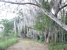
 Laguna de Sonso tropical dry forest in Northern Andes (from Andes)
 -

.jpg)


%E2%80%93Valle_Carbajal_01.jpg)
.jpg)


.JPG)


.jpg)


Subcategories

- Select [►] to view subcategories
Related portals
Subtopics
Associated Wikimedia
The following Wikimedia Foundation sister projects provide more on this subject:
-
 Commons
Free media repository -
 Wikibooks
Free textbooks and manuals -
 Wikidata
Free knowledge base -
 Wikinews
Free-content news -
 Wikiquote
Collection of quotations -
 Wikisource
Free-content library -
 Wikiversity
Free learning tools -
 Wiktionary
Dictionary and thesaurus


