
Abbotsford Station, Queensland
This article has multiple issues. Please help improve it or discuss these issues on the talk page. (Learn how and when to remove these template messages)
|
Abbotsford Station is a 20,000 acres (8,100 ha) mitchell grass downs block near Stamford, Queensland, Australia. The block was balloted on the 7 November 1912 off the Stamfordham block of the home station of Katandra. It was the western portion of the block called Sloane Creek, so named after the creek that runs through the block and into the Flinders River. This block also had a sub-artesian bore (completed in 1904) which was situated centrally on the land making it the prime block in the 1912 ballot process.
Abbotsford Station is situated 87 kilometres (54 mi) south-west of Hughenden, and 24 kilometres (15 mi) west of Stamford which is situated on the Hughenden-Winton Road (Kennedy Developmental Road).
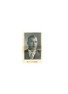
The successful applicant for the block was Charles John Burdekin (Chas) Abbott (born 8 February 1878) whose family had land interests in Charters Towers at Fanning River and Ingham at Elma Grove.
See also[edit]
References[edit]
- Fox, M.J. (1923) "The history of Queensland : its people and industries" : an historical and commercial review, descriptive and biographical facts, figures and illustrations : an epitome of progress, p. 520-521