Allt-fawr
| Allt-fawr | |
|---|---|
 Allt Fawr from the Rhosydd quarry | |
| Highest point | |
| Elevation | 698 m (2,290 ft) |
| Prominence | 243 m (797 ft) |
| Parent peak | Moelwyn Mawr |
| Listing | Marilyn, Hewitt, Nuttall |
| Coordinates | 53°00′27″N 3°58′02″W / 53.00762°N 3.96726°W |
| Naming | |
| English translation | big slope |
| Language of name | Welsh |
| Pronunciation | Welsh: [ˈaɬt ˈvau̯r] |
| Geography | |
| Parent range | Snowdonia |
| OS grid | SH681474 |
| Topo map | OS Landranger 115 |
| Name | Grid ref | Height | Status |
|---|---|---|---|
| Cnicht | 689 m (2,260 ft) | Hewitt, Nuttall | |
| Moel Druman | 676 m (2,218 ft) | Hewitt, Nuttall | |
| Ysgafell Wen | 672 m (2,205 ft) | Hewitt, Nuttall | |
| Ysgafell Wen North Top | 669 m (2,195 ft) | Hewitt, Nuttall | |
| Moel Meirch | 609 m (1,998 ft) | sub Hewitt |
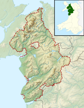
Allt-fawr is a mountain in Snowdonia, North Wales and forms part of the Moelwynion group.
It is on the internal border of Snowdonia National Park, and overlooks the town of Blaenau Ffestiniog, with its numerous slate quarries, as well as Llyn Ystradau and Ffestiniog Power Station in Tanygrisiau.[1] On the northern slope of Allt-fawr is the Oakeley Quarry, the world's largest underground slate mine.[citation needed] On the southern slope is the large Cwmorthin Quarry. These two mines are joined underneath the summit of Allt-fawr and the extensive chambering and adits are visible on the surface of the mountain where underground workings have collapsed.[2]
Between 1974 and 1997, the Gloddfa Ganol tourist attraction operated within the Oakeley Quarry on the south slope of the mountain.
References[edit]
- ^ Nuttall, John & Anne (1999). The Mountains of England & Wales - Volume 1: Wales (2nd edition ed.). Milnthorpe, Cumbria: Cicerone. ISBN 1-85284-304-7.
- ^ J.G. Isherwood (1980). Candles to Caplamps: the Story of Gloddfa Ganol. Gloddfa Ganol.
External links[edit]

