
Anthara Santhe
Anthara Santhe | |
|---|---|
village cluster | |
 Antharasanthe village | |
| Coordinates: 12°01′06″N 76°17′57″E / 12.018418°N 76.299185°E | |
| Country | |
| State | Karnataka |
| District | Mysore |

Anthare Santhe is a small town near Nagarhole National Park in Heggadadevankote, Mysore district, Karnataka, India.
Location[edit]
Anthare Santhe is the nucleus of a series of villages situated deep inside the Nagerhole forest of Karnataka state. Kabini river and reservoir lies on the eastern side of all these villages.
Balle Elephant Camp[edit]
Balle Elephant Camp is located near the Anthare Santhe village. It is part of the Nagerhole national forest and it is located at the Balle checkpost.
Education[edit]
Honnamannakatte High School is the main educational organization in Anthara Santhe.
Suburbs and villages[edit]
- D.B.Kuppe
- Machur
- Karapura
- Nisana Belathur
- Hemmankette
- Dommanakatete
- Lakshmi pura
See also[edit]
Image gallery[edit]
-
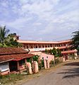 Hemmankette village
 -
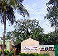 Nisana Belathur school
 -
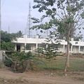 Anthare Santhe village
 -
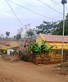
 Malali village
 -
 Manche Gowdanehalli


Wikimedia Commons has media related to Anthara Santhe.