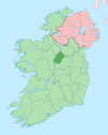
Aughnacliffe
Aughnacliffe
Achadh na Cloiche | |
|---|---|
Village | |
| Coordinates: 53°50′48″N 7°36′17″W / 53.8468°N 7.6046°W | |
| Country | Ireland |
| Province | Leinster |
| County | County Longford |
| Population (2016)[1] | 177 |
Aughnacliffe, officially Aghnacliff (Irish: Achadh na Cloiche, meaning "field of the stones"),[2] is a village in County Longford, Ireland. It is located close to Lough Gowna and the border with County Cavan.
The village, and the townland in which it is located, take their name from the Aughnacliffe Dolmen, a portal tomb which is located nearby.[3] There are a number of other megalithic sites in the area, and Sonnagh fort (a ringfort or rath) lies approximately 1.5 km (0.93 mi) south of the village.[3] The local Roman Catholic Church is dedicated to St. Columcille and was built in 1834.[4] St. Thomas's Church Of Ireland church, in the neighbouring townland of Rathmore, was built in 1829.[5][6] The local GAA club is Colmcille GFC.[7]
References[edit]
- ^ "Sapmap Area - Settlements - Aughnacliffe". Census 2016. Central Statistics Office. April 2016. Archived from the original on 24 September 2021. Retrieved 31 January 2020.
- ^ "Aughnacliffe / Achadh na Cloiche". logainm.ie. Irish Placenames Commission. Retrieved 31 January 2020.
- ^ a b "Towns & Villages - Aughnacliffe". longford.ie. Longford County Council. Retrieved 31 January 2020.
The dolmen in Aughnacliffe gives the townland its name "The Field of the Stones"
- ^ "St. Columkille's Roman Catholic Church, Aghnacliff, County Longford". buildingsofireland.ie. National Inventory of Architectural Heritage. Retrieved 31 January 2020.
- ^ "St. Thomas Church Of Ireland, Rathmore (granard By.), County Longford". buildingsofireland.ie. National Inventory of Architectural Heritage. Retrieved 31 January 2020.
- ^ "Co. Longford, Aughnacliffe, Church Of St Thomas (CI, Parish Of Columbkille". Dictionary of Irish Architects. Irish Architectural Archive. Retrieved 31 January 2020.
- ^ "Rural broadband: Full list of high-speed internet hubs". The Irish Times.


