Baraolt Mountains


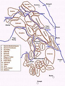
The Baraolt Mountains (Romanian: Munții Baraolt) is a mountain range, entirely in Covasna County of Romania.[1]
Geologically the Baraolts are part of the Inner Eastern Carpathians. By traditional Romanian categorization it's included in the Curvature Carpathians.
The largest city in the area is Sfântu Gheorghe, along with the town of Baraolt. The highest peak is Vârful Havad at 1,019 metres (3,343 feet). The Baraolt Mountains is a popular hiking area.
References[edit]
- ^ Aparaschivei, O.; Sparchez, Gh (2012-07-24). "Study of Phytogeographic and Physical Conditions from the Baraolt and Bodoc Mountains". Bulletin of the Transilvania University of Brasov. Series II: Forestry • Wood Industry • Agricultural Food Engineering: 13–18. ISSN 2065-2143.
