
Batuco, Santiago
This article needs additional citations for verification. (December 2009) |
Batuco, Santiago | |
|---|---|
 Part of Batuco from above. | |
 Batuco, Santiago Location in Chile  Batuco, Santiago Batuco, Santiago (South America) | |
| Coordinates: 33°13′50″S 70°48′33″W / 33.23056°S 70.80917°W | |
| Area | |
| • Total | 3.659 km2 (1.413 sq mi) |
| Elevation | 650 m (2,130 ft) |
| Population | |
| • Total | 16,784 |
| • Density | 4,587/km2 (11,880/sq mi) |
| Postal code [2] | 9380000 |
Batuco is a locality of Chile, situated in the commune of Lampa. Its population was 16,784 as of the 2017 census.
Geography[edit]
Batuco is located in the Chacabuco portion of the Santiago Metropolitan Region. Lo Solar lies directly south of Batuco and Huertos Familiares lies directly north of Batuco. Batuco is 17 miles (28 km) northwest from downtown Santiago and 48 miles (77 km) to Valparaíso.
Landmarks[edit]
Approximately 2 miles (3 km) northwest of Batuco, exists a lagoon commonly known as the Batuco lagoon with a surface area of about 300 hectares. A majority of the land around the lagoon is a wetland. Together, the lagoon and wetland are known for their variety of bird species. The lagoon also contains large levels of nutrients, phosphorus, nitrogen and chlorophyll.[3]

Gallery[edit]
-
 Part of Batuco from above.
 -
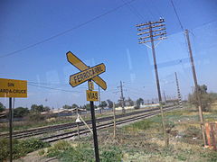 Abandoned railroad in Batuco.
 -
 Alternative view of an abandoned railroad in Batuco.
 -
 Main plaza in Batuco.
 -
 Catholic church in Batuco.
 -
 Snowy field in Batuco.
 -
 Yellow-billed teal in the Batuco wetlands.


References[edit]
- ^ "Batuco (Chacabuco, Región Metropolitana de Santiago, Chile) - Population Statistics, Charts, Map, Location, Weather and Web Information". citypopulation.de. Retrieved 2024-05-01.
- ^ "Lampa, Chile Postal Codes". worldpostalcode.com. Retrieved 2024-05-01.
- ^ "Conoce Laguna de Batuco – Laguna de Batuco". santuariolagunabatuco.cl. Retrieved 2024-05-01.
33°13′51″S 70°48′32″W / 33.2308°S 70.8089°W
This Santiago Metropolitan Region location article is a stub. You can help Wikipedia by expanding it. |