
Botala
Botala بوتالہ | |
|---|---|
Village and union council | |
 | |
| Country | Pakistan |
| Region | Punjab Province |
| District | Khushab District |
| Population | |
| • Total | 36,000 |
| Time zone | UTC+5 (PST) |
Botala (Urdu: بوتالہ), is a village and one of the 51 Union Councils of Khushab District in the Punjab Province of Pakistan. It is situated 2.0 km south from the main Mianwali-Lahore road. It is about 12 kilometers distance from district headquarters Jauahrabad and 60 kilometers from divisional headquarters Sargodha.
Areas[edit]
- Area: about 10,000 acres (40 km2).
- Sub Areas: Pindi, Jhugi Manday Wali, Handan Wala, Balkian Aala Boad, Neher Pul Jabbi
- Different parts of the agricultural areas of the village: Tapian, Gada Maar, Jhugi Manday Wali, Hadan Wala, Shero, Kamoon
Population[edit]
Population is about 36,000.
City of Tiwanas and their offshoots
Such as Qutbi ,bilwal,sawani,gulsheri,dhuddi and many more. Mostly Population is concists of Tiwana's offshoots.Thaheem family is not in abundance.
Six sons of Khan Muhammad Thaheem being relevant to Qasais Families , dwelling in Botala , Mitha tiwana, Jabbi and dhokrhi as well as in Jauharabad and Khushab.
Geography[edit]
The lands of the village are fertile with 98% irrigated areas and 2% desert.
Economy[edit]
- Crops: The major crops of botala are sugarcane, rice, wheat, etc.
- Canal and irrigation system: There are 5 major canals in the lands of Botala. Hundreds of water courses are lying there.
- Deserts: The great Thal Desert starts from Botala and its native town Hadali as well.
PICS Gallery[edit]
-
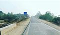
 Botala, Khushab
 -
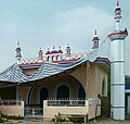 Masjid @ Botala Adda
 -

-
 Hotel @ Botala Adda
 -
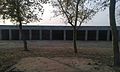
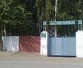 Govt Elementary School for Boys, Botala
 -
 Govt Elementary School for Girls, Botala
 -
 Head, Botala
 -
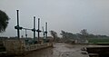
 Botala Miner Canal
 -
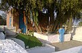 Darbar Baba Qamer Ali, Botala
 -
 Janaza Gah, Botala
 -
 View of Botala Adda
 -
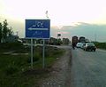
 Botala Entrance
 -
 Botala-42 chak road
 -
 Loc. Near Govt Boys School
 -
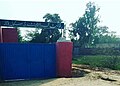
 Basic Health Unit
 -
 Pindi, Botala
 -
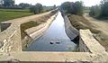
 بوتالہ نہر


References[edit]
External links[edit]
![]() Media related to Botala at Wikimedia Commons
Media related to Botala at Wikimedia Commons
Administrative divisions of Khushab District | ||
|---|---|---|
| Capital |  | |
| Tehsils | ||
| Towns | ||
| Union councils |
| |