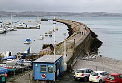
Brixham Breakwater
| Brixham Breakwater | |
|---|---|
 The breakwater in 2017 | |
 | |
| Alternative names | Victoria Breakwater |
| General information | |
| Type | Coastal breakwater |
| Town or city | Brixham, Devon |
| Country | England |
| Coordinates | 50°24′10″N 3°30′30″W / 50.4027°N 3.5083°W |
Brixham Breakwater is a coastal breakwater situated at the town of Brixham in Devon, England. The breakwater provides shelter for vessels mooring at the port, including the historic Brixham fishing fleet. The building of the structure to its final length spanned several decades, with work beginning in 1843 to the design of the local civil engineer James Meadows Rendel[1][2] and being completed in 1916, when the present cast-iron lighthouse was installed at the pier end.


References[edit]
- ^ Skempton, A. W. (2002). A Biographical Dictionary of Civil Engineers in Great Britain and Ireland, Volume 1. Thomas Telford. p. 550. ISBN 9780727729392.
- ^ GENUKI. "Genuki: Brixham 1868". www.genuki.org.uk. Retrieved 2020-04-25.
