
Crawford, Kansas
Crawford, Kansas | |
|---|---|
 | |
 Crawford  Crawford | |
| Coordinates: 38°30′48″N 98°2′6″W / 38.51333°N 98.03500°W[1] | |
| Country | United States |
| State | Kansas |
| County | Rice |
| Township | Galt |
| Elevation | 1,690 ft (520 m) |
| Population | |
| • Total | 0 |
| Time zone | UTC-6 (CST) |
| • Summer (DST) | UTC-5 (CDT) |
| Area code | 620 |
| FIPS code | 20-16275 [1] |
| GNIS ID | 484739 [1] |
Crawford is a ghost town in Galt and Odessa Townships in Rice County, Kansas, United States.[1] It lies along K-4 about 6 miles (9.7 km) east of Geneseo.[2]
History[edit]
For millennia, the land now known as Kansas was inhabited by Native Americans. In 1803, most of modern Kansas was secured by the United States as part of the Louisiana Purchase. In 1854, the Kansas Territory was organized, then in 1861 Kansas became the 34th U.S. state. In 1867, Rice County was founded.
Crawford had a post office from the 1880s until 1953.[3]
References[edit]
- ^ a b c d e "Crawford, Kansas", Geographic Names Information System, United States Geological Survey, United States Department of the Interior
- ^ DeLorme. Kansas Atlas & Gazetteer. 4th ed. Yarmouth: DeLorme, 2009, p. 47. ISBN 0-89933-342-7.
- ^ "Kansas Post Offices, 1828-1961". Kansas Historical Society. Archived from the original on October 9, 2013. Retrieved June 22, 2014.
Further reading[edit]
Municipalities and communities of Rice County, Kansas, United States | ||
|---|---|---|
| Cities | 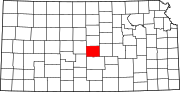 | |
| Unincorporated communities | ||
| Ghost towns | ||
| Townships | ||
This article about a location in Rice County, Kansas is a stub. You can help Wikipedia by expanding it. |