Defne
Defne | |
|---|---|
District and municipality | |
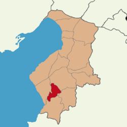
 Map showing Defne District in Hatay Province | |
| Coordinates: 36°11′18″N 36°8′52″E / 36.18833°N 36.14778°E | |
| Country | Turkey |
| Province | Hatay |
| Government | |
| • Mayor | İbrahim Güzel (CHP) |
| Area | 155 km2 (60 sq mi) |
| Population (2022)[1] | 165,494 |
| • Density | 1,100/km2 (2,800/sq mi) |
| Time zone | UTC+3 (TRT) |
| Postal code | 31160 |
| Area code | 0326 |
| Website | www |
Defne is a municipality and district of Hatay Province, Turkey.[2] Its area is 155 km2,[3] and its population is 165,494 (2022).[1] The district Defne was created in 2013 from parts of the former central district of Hatay and the district of Samandağ.[4][5] It covers the southwestern part of the agglomeration of Antakya and the adjacent countryside.
Defne was heavily damaged by powerful earthquakes in February 2023 and subsequent aftershocks.[6]
The municipality of Defne was named after the Greek mythological figure of Daphne.[7] Tourist sites in Defne include the Harbiye Hydro Park and Harbiye Waterfall, as well as the historic site of St Simeon's Monastery.[8]
Composition[edit]
There are 37 neighbourhoods in Defne District:[9]
- Akdeniz
- Aknehir
- Armutlu
- Aşağıokçular
- Bahçeköy
- Balıklıdere
- Ballıöz
- Bostancık
- Büyükçat
- Çardaklı
- Çekmece
- Çınarlı
- Çökek
- Değirmenyolu
- Döver
- Dursunlu
- Elektrik
- Gümüşgöze
- Güneysöğüt
- Hancağız
- Harbiye
- Hüseyinli
- Karşıyaka
- Koçören
- Meydancık
- Orhanlı
- Özbek
- Samankaya
- Sinanlı
- Subaşı
- Sümerler
- Tavla
- Toygarlı
- Turunçlu
- Üzengili
- Yeniçağ
- Yeşilpınar
References[edit]
- ^ a b "Address-based population registration system (ADNKS) results dated 31 December 2022, Favorite Reports" (XLS). TÜİK. Retrieved 19 September 2023.
- ^ Büyükşehir İlçe Belediyesi, Turkey Civil Administration Departments Inventory. Retrieved 19 September 2023.
- ^ "İl ve İlçe Yüz ölçümleri". General Directorate of Mapping. Retrieved 19 September 2023.
- ^ "Law No. 6360". Official Gazette (in Turkish). 6 December 2012.
- ^ "İl İdaresi ve Mülki Bölümler Şube Müdürlüğü İstatistikleri - İl ve İlçe Kuruluş Tarihleri" (PDF) (in Turkish). p. 39. Retrieved 20 September 2023.
- ^ "Hatay'da ağır yıkımın bilançosu..." [The result of the heavy destruction in Hatay...] (in Turkish). Iskenderun.org. 2023-04-08.
- ^ "DEFNE – Defne Belediyesi" (in Turkish). Retrieved 2020-01-11.
- ^ "TARİHİ & TURİSTİK YERLER – Defne Belediyesi" (in Turkish). Retrieved 2020-01-11.
- ^ Mahalle, Turkey Civil Administration Departments Inventory. Retrieved 19 September 2023.


