Draft:Kerman Rock
| Submission declined on 12 December 2023 by Oltrepier (talk). This draft's references do not show that the subject qualifies for a Wikipedia article. In summary, the draft needs multiple published sources that are:
This is not a bad start at all, but I think you should try to find a few more independent sources, if possible; plus, there are some glaring problems with formatting...
I'd suggest you to take a look at the guidelines of WikiProject Mountains to learn how to improve the draft. This infobox should be pretty useful, as well!
Where to get help
How to improve a draft
You can also browse Wikipedia:Featured articles and Wikipedia:Good articles to find examples of Wikipedia's best writing on topics similar to your proposed article. Improving your odds of a speedy review To improve your odds of a faster review, tag your draft with relevant WikiProject tags using the button below. This will let reviewers know a new draft has been submitted in their area of interest. For instance, if you wrote about a female astronomer, you would want to add the Biography, Astronomy, and Women scientists tags. Editor resources
|  |
| Kerman Rock | |
|---|---|
| Highest point | |
| Elevation | 399 |
| Geography | |
| Country | |
| Estado | State of Western Australia |
| Kerman Rock | |
| Bato | |
| Nasod | Australia |
|---|---|
| Estado | State of Western Australia |
| Gitas-on | 399 m (1,309 ft) |
| Tiganos | 31°02′41″S 118°54′23″E / 31.04485°S 118.9065°Ö |
| Timezone | AWST (UTC+8) |
| GeoNames | 2068555 |
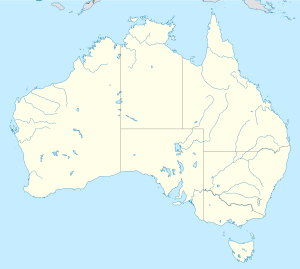
Kerman Rock is a geological formation and locality in Australia. It is located in the State of Western Australia, in the western part of the country, 2,800 km west of the captial of Canberra. Kerman Rock has an average elevation of 399 meters above sea level.[1] It is located inside State Reserve 1319.[2] The nearest larger towns are Merredin and Southern Cross. There was a State Primary and High School in the area named "Kerman Rock" in the 1940s and 1950s.[3][4]
The land around Kerman Rock is mostly flat, with the unique granite rock formation[5] standing out above the surrounding landscape. The highest place in the area has a height of 418 meters and is 2.2 km east of Kerman Rock. Less than 2 people per square kilometer live in the primarily agriculturally used landscape around Kerman Rock.[6].
The geological area Kerman Rock is mostly covered in dense bush.[7] The climate is dry and semi-arid.[8] The average temperature is 20 °C. The hottest month is January with an average of 32 °C, and the coldest is July with 9 °C.[9] The average rainfall is 362 millimeters per year. The wettest month is July, with 45 millimeters of rain, and the driest is February, with 11 millimeters..[10]
| ||||||||||||||||||||||||||||||||||||||||||||||||||||||||||||||||||||||||||||||||||||||||||||||||||||||||||||||||
<references> [1] [11] [12] [13] [14] [15]
References[edit]
- ^ a b Kerman Rock sa GeoNames.Org (cc-by); post updated 2014-04-08; database download sa 2023-12-05
- ^ "Best Hiking Trails near Kerman Rock". GaiaGPS.com. Retrieved 2023-12-05.
- ^ "School Teachers of Western Australia". www.carnamah.com.au. Retrieved 2023-12-05.
- ^ "School Teachers of Western Australia". www.carnamah.com.au. Retrieved 2023-12-05.
- ^ "Granite Discovery (North) » Visit Yilgarn". visit.yilgarn.wa.gov.au. Retrieved 2023-12-05.
- ^ "NASA Earth Observations: Population Density". NASA/SEDAC. Archived from the original on 9 February 2016. Retrieved 30 January 2016.
- ^ "NASA Earth Observations: Land Cover Classification". NASA/MODIS. Archived from the original on 28 February 2016. Retrieved 30 January 2016.
- ^ Peel, M C; Finlayson, B L (2007). "Updated world map of the Köppen-Geiger climate classification". Hydrology and Earth System Sciences. 11 (5): 1633–1644. Bibcode:2007HESS...11.1633P. doi:10.5194/hess-11-1633-2007. Retrieved 30 January 2016.
- ^ "NASA Earth Observations Data Set Index". NASA. Archived from the original on 10 May 2020. Retrieved 30 January 2016.
- ^ "NASA Earth Observations: Rainfall (1 month - TRMM)". NASA/Tropical Rainfall Monitoring Mission. Archived from the original on 19 April 2019. Retrieved 30 January 2016.
- ^ "Viewfinder Panoramas Digital elevation Model". 2015-06-21.
- ^ Peel, M C; Finlayson, B L (2007). "Updated world map of the Köppen-Geiger climate classification". Hydrology and Earth System Sciences. 11 (5): 1633–1644. Bibcode:2007HESS...11.1633P. doi:10.5194/hess-11-1633-2007. Retrieved 6 December 2023.
- ^ "NASA Earth Observations Data Set Index". NASA. Archived from the original on 10 May 2020. Retrieved 6 December 2023.
- ^ "NASA Earth Observations: Rainfall (1 month - TRMM)". NASA/Tropical Rainfall Monitoring Mission. Archived from the original on 19 April 2019. Retrieved 6 December 2023.
- ^ "NASA Earth Observations: Land Cover Classification". NASA/MODIS. Archived from the original on 28 February 2016. Retrieved 6 December 2023.
Category:Western Australia Category:Australia Category:Geologic formations of Australia

