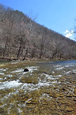
Dry Fork (Tug Fork tributary)
This article needs additional citations for verification. (June 2011) |
| Dry Fork | |
|---|---|
 Flowing through McDowell County | |
| Location | |
| Country | United States |
| Physical characteristics | |
| Source | |
| • location | Stony Ridge near Adria, Tazewell County, Virginia |
| Mouth | |
• location | Tug Fork at Iaeger, McDowell County, West Virginia |
The Dry Fork is a 47.7-mile-long (76.8 km)[1] tributary of the Tug Fork, belonging to the Ohio River watershed. The river is located in McDowell County, West Virginia, and Tazewell County, Virginia, in the United States.[2] The mouth of the Dry Fork into the Tug Fork is located at Iaeger.
Variant names[edit]
According to the United States Geological Survey's Geographic Names Information System, the Dry Fork has been known by the following names throughout its history:
- Crane Creek
- Mud Fork
- South Fork
Tributaries[edit]
Tributary streams are listed from source to mouth.
- Lick Branch
- Ray Fork
- Bills Branch
- Dick Creek
- Laurel Fork
- Mile Branch
- Beech Fork
- Vall Creek
- Kewee Creek
- Big Branch
- Jacobs Fork
- Johns Branch
- War Creek
- Barrenshe Creek
- Pruett Branch
- Threefork Branch
- Bartley Creek
- Buck Fork
- Johnnycake Hollow
- Atwell Branch
- Little Slate Branch
- Right Fork
- Dry Branch
- Bradshaw Creek
- Oozley Branch
- Hurricane Branch
- Fishtrap Branch
- Beartown Branch
- Little Staunch Branch
- Staunch Branch
- Grapevine Branch
- Betsy Branch
- Crane Creek
- Left Fork
- Laurel Fork
- Mile Branch
- Straight Branch
- Coon Branch
List of cities and towns along the Dry Fork[edit]
- Apple Grove, West Virginia
- Atwell, West Virginia
- Avondale, West Virginia
- Bartley, West Virginia
- Beartown, West Virginia
- Berwind, West Virginia
- Bradshaw, West Virginia
- Canebrake, West Virginia
- Carlos, West Virginia
- Dunford Village, Virginia
- English, West Virginia
- Excelsior, West Virginia
- Garland, West Virginia
- Iaeger, West Virginia
- Lex, West Virginia
- Lomax, West Virginia
- Raysal, West Virginia
- Rift, West Virginia
- Union City, West Virginia
- Vallscreek, West Virginia
- War, West Virginia
- Yukon, West Virginia
See also[edit]
References[edit]
- ^ U.S. Geological Survey. National Hydrography Dataset high-resolution flowline data. The National Map Archived 2012-03-29 at the Wayback Machine, accessed June 13, 2011
- ^ U.S. Geological Survey Geographic Names Information System: Dry Fork (Tug Fork tributary)
37°27′45″N 81°49′03″W / 37.46250°N 81.81750°W
