File:ÖPNV-Systeme auf den Britischen Inseln.png

Page contents not supported in other languages.
This is a file from the Wikimedia Commons
From Wikipedia, the free encyclopedia

Original file(1,845 × 2,715 pixels, file size: 512 KB, MIME type: image/png)

Description
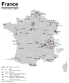
  • Deutsch: Karte der streckengebundenen Nahverkehrssysteme (S-Bahn, U-Bahn, Stadtbahn, Straßenbahn, O-Bus) des Vereinigten Königreichs und Irlands
  • English: Map of fixed-route public transport systems (suburban railways, Rapid Transit and Light Rail Transit systems, tram, trolleybus) in the United Kingdom and in Ireland
  • Français : Carte des réseaux de transports en commun de la Royaume Unie et de l'Irlande avec systèmes RER, tram-train, métro, métro léger, tramway ou trolleybus
Date see file history
Source

Own work using:

Author Maximilian Dörrbecker (Chumwa)
Permission
(Reusing this file)
I, the copyright holder of this work, hereby publish it under the following license:
w:en:Creative Commons
attribution share alike
This file is licensed under the Creative Commons Attribution-Share Alike 2.5 Generic license.
You are free:
  • to share – to copy, distribute and transmit the work
  • to remix – to adapt the work
Under the following conditions:
  • attribution – You must give appropriate credit, provide a link to the license, and indicate if changes were made. You may do so in any reasonable manner, but not in any way that suggests the licensor endorses you or your use.
  • share alike – If you remix, transform, or build upon the material, you must distribute your contributions under the same or compatible license as the original.

Sie dürfen das Bild zu den folgenden Bedingungen nutzen:

  • Sie müssen den Namen des Autors nennen.
  • Im Falle einer Verbreitung müssen Sie anderen die Lizenzbedingungen, unter die dieses Bild fällt, mitteilen.
  • Sie müssen das Bild unter gleichen Bedingungen weitergeben. Wenn sie das Bild abändern oder Arbeiten auf diesem Bild aufbauen, müssen Sie das Ergebnis aus dieser Arbeit ebenfalls unter diese Lizenz stellen.
  • Jede dieser Bedingungen kann nach schriftlicher Einwilligung des Rechtsinhabers aufgehoben werden.
 
Other versions


Benelux

China

Czech Republic

France

Germany

Italy

Japan

Korea

Poland

Spain & Portugal

Turkey

British Isles

Former Soviet Union

Balkans

North Africa

Latin America

United States of America

Captions

Add a one-line explanation of what this file represents

Items portrayed in this file

depicts

File history

Click on a date/time to view the file as it appeared at that time.

Date/TimeThumbnailDimensionsUserComment
current05:36, 10 July 2015Thumbnail for version as of 05:36, 10 July 20151,845 × 2,715 (512 KB)Chumwa{{Information |Description= *{{de|Karte der streckengebundenen Nahverkehrssysteme (S-Bahn, U-Bahn, Stadtbahn, Straßenbahn, O-Bus) des Vereinigten Königreichs und Irlands}} *{{en|Map of fixed-route public transport systems (suburban railways, Rapid Tr...
The following pages on the English Wikipedia use this file (pages on other projects are not listed):

Global file usage

The following other wikis use this file:

Metadata