
File:Castell Dinas from the air.jpg
Size of this preview: 800 × 549 pixels. Other resolutions: 320 × 220 pixels | 640 × 439 pixels | 1,024 × 703 pixels | 1,280 × 879 pixels | 2,560 × 1,757 pixels | 3,000 × 2,059 pixels.
Original file (3,000 × 2,059 pixels, file size: 7.33 MB, MIME type: image/jpeg)
| This is a file from the Wikimedia Commons. Information from its description page there is shown below. Commons is a freely licensed media file repository. You can help. |
Summary
| Description |
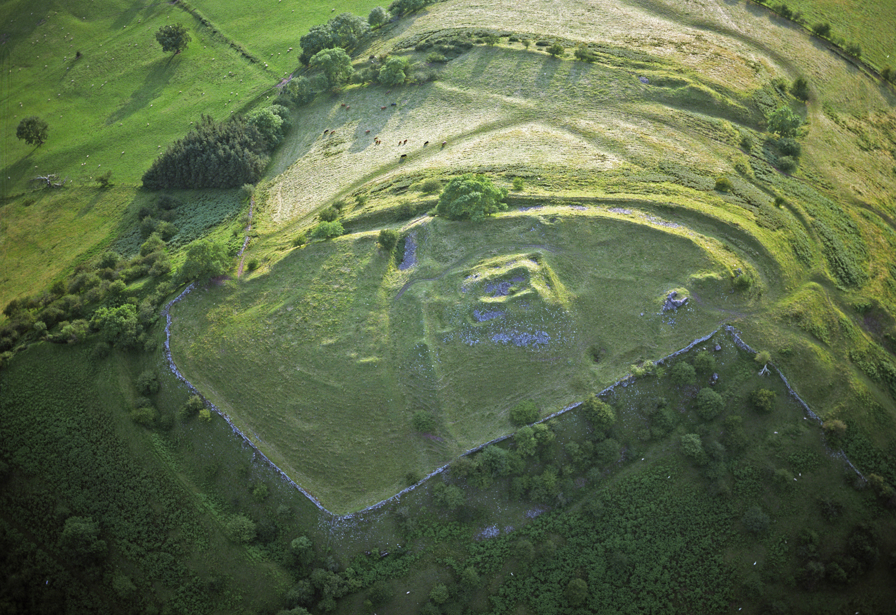
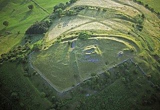
English: Castell Dinas Castle seen from the air, with remains of norman keep and earthworks clearly visible. |
| Date | |
| Source | Own work |
| Author | Jasper Fforde |
| Object location | | View this and other nearby images on: OpenStreetMap |
|---|
Licensing
I, the copyright holder of this work, hereby publish it under the following license:
This file is licensed under the Creative Commons Attribution-Share Alike 3.0 Unported license.
- You are free:
- to share – to copy, distribute and transmit the work
- to remix – to adapt the work
- Under the following conditions:
- attribution – You must give appropriate credit, provide a link to the license, and indicate if changes were made. You may do so in any reasonable manner, but not in any way that suggests the licensor endorses you or your use.
- share alike – If you remix, transform, or build upon the material, you must distribute your contributions under the same or compatible license as the original.
File history
Click on a date/time to view the file as it appeared at that time.
| Date/Time | Thumbnail | Dimensions | User | Comment | |
|---|---|---|---|---|---|
| current | 19:51, 5 February 2013 | | 3,000 × 2,059 (7.33 MB) | Jasperfforde | User created page with UploadWizard |
File usage
The following pages on the English Wikipedia use this file (pages on other projects are not listed):
Global file usage
The following other wikis use this file:
- Usage on ceb.wikipedia.org
- Usage on cy.wikipedia.org
- Usage on de.wikipedia.org
- Usage on www.wikidata.org