
File:Conjectural Belting Diagram - Robbins and Lawrence Armory, 196 Main Street, Windsor, Windsor County, VT HAER VT-39 (sheet 12 of 12).tif

Size of this JPG preview of this TIF file: 400 × 600 pixels. Other resolutions: 160 × 240 pixels | 320 × 480 pixels | 512 × 768 pixels | 682 × 1,024 pixels | 1,365 × 2,048 pixels | 9,600 × 14,400 pixels.
Original file (9,600 × 14,400 pixels, file size: 332 KB, MIME type: image/tiff)
| This is a file from the Wikimedia Commons. Information from its description page there is shown below. Commons is a freely licensed media file repository. You can help. |
Summary
| Warning | The original file is very high-resolution. It might not load properly or could cause your browser to freeze when opened at full size. |
|---|
| Conjectural Belting Diagram - Robbins and Lawrence Armory, 196 Main Street, Windsor, Windsor County, VT | ||||
|---|---|---|---|---|
| Photographer |
Marston, Christopher H. |
|||
| Title |
Conjectural Belting Diagram - Robbins and Lawrence Armory, 196 Main Street, Windsor, Windsor County, VT |
|||
| Description |
Robbins and Lawrence Company; Windsor Manufacturing Company; Jones, Lamson and Company; Windsor Electric Light Company; Central Vermont Public Service Company; American Precision Museum; Robbins, Samuel E.; Lawrence, Ricard S.; Kendall, Nicanor; Battison, Edwin A.; Marston, Christopher H, project manager; Johnson, John P, historian; Lawless, Ann, sponsor; Carpenito, Jessica, delineator; Osorio, German, delineator; Sardadi, Arvi, delineator; Wickham, Russell C, delineator; Gorohkov, Pavel, delineator; Lowe, Jet, photographer |
|||
| Depicted place | Vermont; Windsor County; Windsor | |||
| Date | 2009 | |||
| Current location |
Library of Congress Prints and Photographs Division Washington, D.C. 20540 USA http://hdl.loc.gov/loc.pnp/pp.print |
|||
| Accession number |
HAER VT-39 (sheet 12 of 12) |
|||
| Credit line |
|
|||
| Notes |
|
|||
| Source | https://www.loc.gov/pictures/item/vt0163.sheet.00012a | |||
| Permission (Reusing this file) |
|
|||
| Other versions |
.png) |
|||

File history
Click on a date/time to view the file as it appeared at that time.
| Date/Time | Thumbnail | Dimensions | User | Comment | |
|---|---|---|---|---|---|
| current | 17:15, 4 August 2014 | 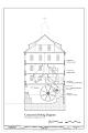 | 9,600 × 14,400 (332 KB) | Fæ | GWToolset: Creating mediafile for Fæ. HABS 2014-08-04 (3601:3800) Penultimate Tranche! |
File usage
The following pages on the English Wikipedia use this file (pages on other projects are not listed):