
File:TTC ACTIVE ROUTE MAP SAMPLE.jpg
Size of this preview: 800 × 600 pixels. Other resolutions: 320 × 240 pixels | 640 × 480 pixels | 1,024 × 768 pixels | 1,280 × 960 pixels | 2,560 × 1,920 pixels | 3,072 × 2,304 pixels.
Original file (3,072 × 2,304 pixels, file size: 1,018 KB, MIME type: image/jpeg)
| This is a file from the Wikimedia Commons. Information from its description page there is shown below. Commons is a freely licensed media file repository. You can help. |
Summary
| Description |
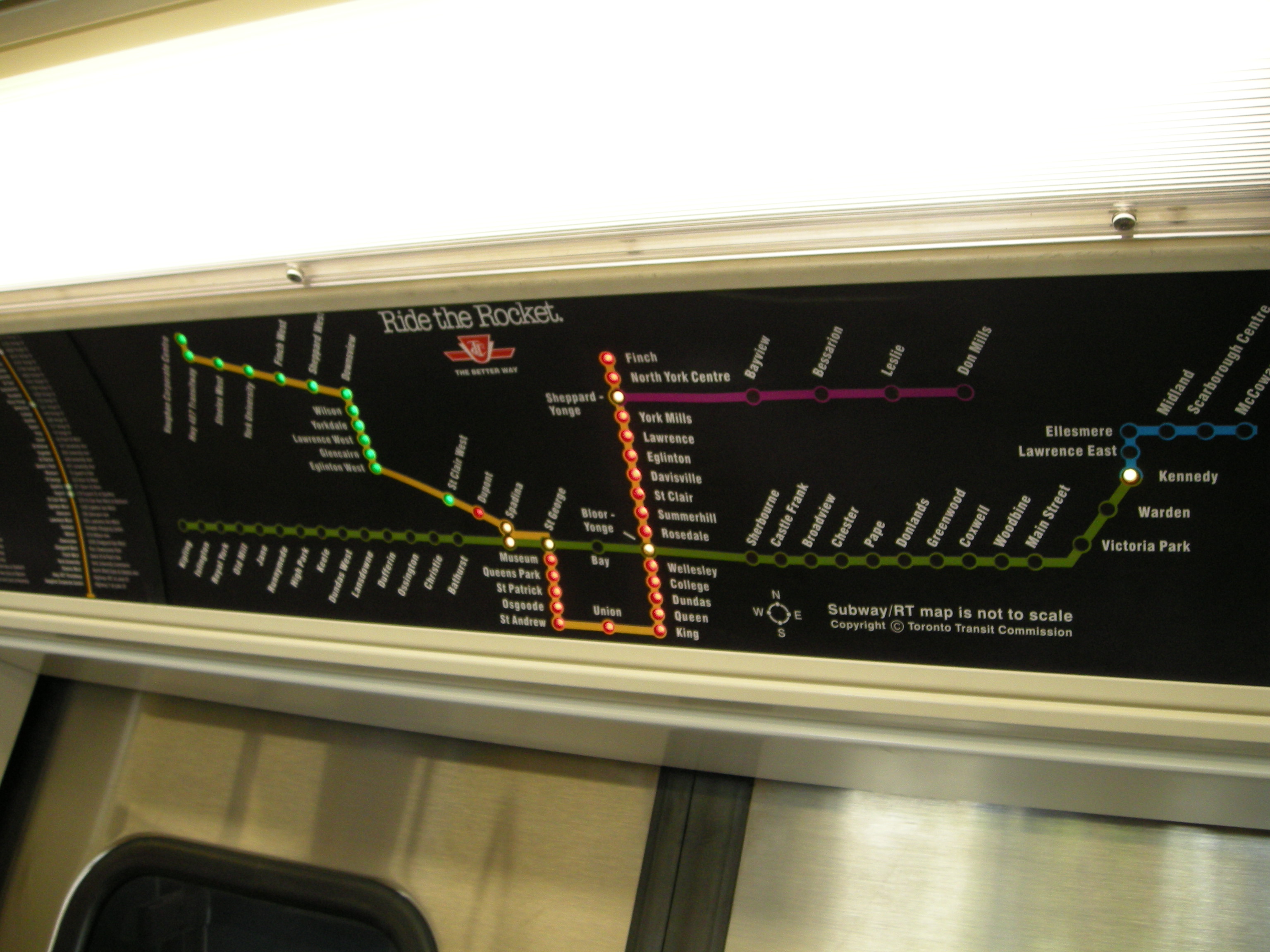
English: A sample of what an "active route map" might look like on TTC vehicles. Taken at the CNE in the mockup of the new subway car. |
| Date | |
| Source | TTC Subway map |
| Author | Neal Jennings from Vancouver, BC, Canada |
| Camera location | | View this and other nearby images on: OpenStreetMap |
|---|
Licensing
This file is licensed under the Creative Commons Attribution-Share Alike 2.0 Generic license.
- You are free:
- to share – to copy, distribute and transmit the work
- to remix – to adapt the work
- Under the following conditions:
- attribution – You must give appropriate credit, provide a link to the license, and indicate if changes were made. You may do so in any reasonable manner, but not in any way that suggests the licensor endorses you or your use.
- share alike – If you remix, transform, or build upon the material, you must distribute your contributions under the same or compatible license as the original.
| This image was originally posted to Flickr by Sweet One at https://www.flickr.com/photos/84987970@N00/2816753852. It was reviewed on 30 September 2009 by FlickreviewR and was confirmed to be licensed under the terms of the cc-by-sa-2.0. |
File history
Click on a date/time to view the file as it appeared at that time.
| Date/Time | Thumbnail | Dimensions | User | Comment | |
|---|---|---|---|---|---|
| current | 06:16, 30 September 2009 | | 3,072 × 2,304 (1,018 KB) | FlickreviewR | Replacing image by its original image from Flickr |
| 02:28, 30 September 2009 |  | 1,024 × 768 (302 KB) | Eja2k | {{Information |Description={{en|1=A sample of what an "active route map" might look like on TTC vehicles}} |Source=http://www.flickr.com/photos/sweetone/2816753852/sizes/l/in/photostream/ |Author=Sweet One |Date= |Permission= |other_versions= }} |
File usage
The following pages on the English Wikipedia use this file (pages on other projects are not listed):
Global file usage
The following other wikis use this file:
- Usage on zh.wikipedia.org