
File:The road through Mithian Downs - geograph.org.uk - 62565.jpg
No higher resolution available.
The_road_through_Mithian_Downs_-_geograph.org.uk_-_62565.jpg (640 × 387 pixels, file size: 89 KB, MIME type: image/jpeg)
| This is a file from the Wikimedia Commons. Information from its description page there is shown below. Commons is a freely licensed media file repository. You can help. |
Summary
| Description |
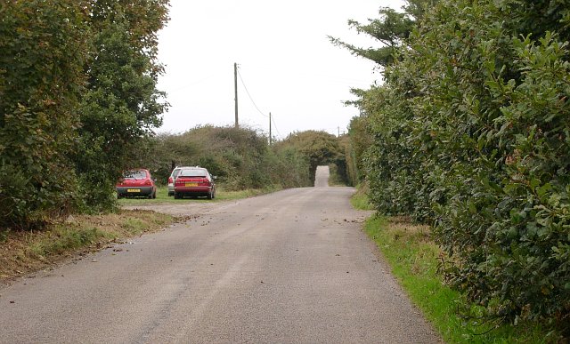
English: The road through Mithian Downs. This minor road runs along the top of the Mithian Downs ridge. It is long and straight and seems to encourage motorists to drive fast, it is not however, heavily used. The Ordnance Survey 1:25,000 map shows a green lane to the east which could be an alternative for the walker, cyclist or horserider. Unfortunately it seems to be completely overgrown and unusable. |
| Date | |
| Source | From geograph.org.uk |
| Author | Tony Atkin |
| Attribution (required by the license) | Tony Atkin / The road through Mithian Downs / |
| Camera location | | View this and other nearby images on: OpenStreetMap |
|---|
_&language=en)
| Object location | | View this and other nearby images on: OpenStreetMap |
|---|
_&language=en)
Licensing

|
This image was taken from the Geograph project collection. See this photograph's page on the Geograph website for the photographer's contact details. The copyright on this image is owned by Tony Atkin and is licensed for reuse under the Creative Commons Attribution-ShareAlike 2.0 license.
|
This file is licensed under the Creative Commons Attribution-Share Alike 2.0 Generic license.
Attribution: Tony Atkin
- You are free:
- to share – to copy, distribute and transmit the work
- to remix – to adapt the work
- Under the following conditions:
- attribution – You must give appropriate credit, provide a link to the license, and indicate if changes were made. You may do so in any reasonable manner, but not in any way that suggests the licensor endorses you or your use.
- share alike – If you remix, transform, or build upon the material, you must distribute your contributions under the same or compatible license as the original.
File history
Click on a date/time to view the file as it appeared at that time.
| Date/Time | Thumbnail | Dimensions | User | Comment | |
|---|---|---|---|---|---|
| current | 20:03, 30 January 2010 | | 640 × 387 (89 KB) | GeographBot | == {{int:filedesc}} == {{Information |description={{en|1=The road through Mithian Downs. This minor road runs along the top of the Mithian Downs ridge. It is long and straight and seems to encourage motorists to drive fast, it is not however, heavily use |
File usage
The following pages on the English Wikipedia use this file (pages on other projects are not listed):
Global file usage
The following other wikis use this file:
- Usage on eu.wikipedia.org
- Usage on www.wikidata.org