
Gandasi
Gandasi | |
|---|---|
Village | |
| Gandasi | |
 Gandasi Location in Karnataka, India | |
| Coordinates: 13°09′34″N 76°18′18″E / 13.159393°N 76.305024°E | |
| Country | |
| State | Karnataka |
| District | Hassan |
| Taluk | Arsikere |
| Government | |
| • Body | Grama Panchayath |
| Area | |
| • Total | 6.58 km2 (2.54 sq mi) |
| Elevation | 930 m (3,050 ft) |
| Population (2011) | |
| • Total | 3,729 [1] |
| Languages | |
| • Official | Kannada |
| Time zone | UTC+5:30 (IST) |
| PIN | 573119 |
| Vehicle registration | KA-13 |
Gandasi is a "hobli" in Hassan district of India. As per census survey of India 2011, the location code number of Gandasi is 615799.
Location[edit]
Gandasi village is located in Arsikere Taluk of Hassan district, Karnataka state, India. The village is located on State Highway 7 between Mysuru and Arsikere.[2]
Postal code[edit]
There is a post office in Gandasi and the postal code is 573119.[3]
Image gallery[edit]
-
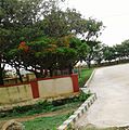 Bus Station
 -
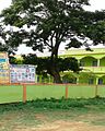 School
.jpg)
.jpg)
See also[edit]
References[edit]
- ^ "Census Data Handbook 2011" (PDF). Retrieved 1 September 2023.
- ^ "13°10'03.1"N 76°17'36.9"E". Google.co.in. Retrieved 23 February 2019.
- ^ "GANDASI Pin Code, Search GANDASI HASSAN PinCode". Citypincode.in. Retrieved 23 February 2019.
This article related to a location in Hassan district, Karnataka, India is a stub. You can help Wikipedia by expanding it. |