
Geyser, Montana
Geyser, Montana | |
|---|---|
 Geyser  Geyser | |
| Coordinates: 47°15′33″N 110°29′36″W / 47.25917°N 110.49333°W[1] | |
| County | Judith Basin County, Montana |
| Area | |
| • Total | 0.89 sq mi (2.31 km2) |
| • Land | 0.89 sq mi (2.31 km2) |
| • Water | 0.00 sq mi (0.00 km2) |
| Elevation | 4,187 ft (1,276 m) |
| Population (2020) | |
| • Total | 78 |
| • Density | 87.64/sq mi (33.84/km2) |
| ZIP Code | 59447 |
| Area code | 406 |
| FIPS code | 30-30550 |
| GNIS feature ID | 0771749[1] |
Geyser is a small, unincorporated rural village in Judith Basin County, Montana, United States, southeast of Great Falls along U.S. Route 87.
History[edit]
The town's name originated from the mud springs in the area in which the town was first founded.[3] P. J. O’Hara, considered the father of Geyser, started a hotel here in 1887, and other businesses soon followed.[3] Geyser was moved to its present location with the construction of the Great Northern rail line between Great Falls and Billings.[4]
Geography[edit]
Geyser is in northwestern Judith Basin County in a broad valley between the Highwood Mountains to the north and the Little Belt Mountains to the south. U.S. Route 87 runs along the south edge of the community, leading 46 miles (74 km) northwest to Great Falls and 15 miles (24 km) southeast to Stanford, the Judith Basin county seat.
According to the U.S. Census Bureau, the Geyser CDP has an area of 0.89 square miles (2.3 km2), all of it recorded as land.[5] The community sits on a low bench between McCarthy Creek to the east and Crow Coulee to the west. The two creeks flow north to Hay Creek, a tributary of Arrow Creek, which flows northeast to the Missouri River.
Demographics[edit]
NB: For Census Bureau study purposes, the village was incorporated within a census-designated place (CDP) in or after 1980. Demographic data extracted from Census Bureau documents after that time will reflect on the entire CDP, not just the village proper.
Population[edit]
| Census | Pop. | Note | %± |
|---|---|---|---|
| 2020 | 78 | — | |
| U.S. Decennial Census[6] | |||
As of the 2020 census, the population of the CDP was 78. The racial makeup of the CDP was 96.8% White, 0.2% Native American, and 2.3% from two or more races. Hispanic or Latino of any race were 0.7% of the population. [1]
As of the 2010 census it had a population of 87.[5]
Education[edit]
Geyser High School's team name is the Wranglers, for sports though, Geyser is co-oped with Stanford and Denton to form the DGS Bearcats.[7] 13 students were enrolled in 2020.[8] In 2023, there were 20 students in the 7th-12th grade range, and 16 students in the PreK-6th grade range.
Media[edit]
The Judith Basin Press is the local newspaper.[9] It is published weekly.
References[edit]
- ^ a b c U.S. Geological Survey Geographic Names Information System: Geyser, Montana
- ^ "ArcGIS REST Services Directory". United States Census Bureau. Retrieved September 5, 2022.
- ^ a b "Geyser". Montana Place Names Companion. Montana Historical Society. Retrieved April 3, 2021.
- ^ "Geyser - Central Montana". centralmontana.com. Retrieved January 22, 2017.
- ^ a b "Geographic Identifiers: 2010 Census Summary File 1 (G001): Geyser CDP, Montana". American Factfinder. U.S. Census Bureau. Archived from the original on February 13, 2020. Retrieved August 22, 2018.
- ^ "Census of Population and Housing". Census.gov. Retrieved June 4, 2016.
- ^ "Member Schools". Montana High School Association. Retrieved April 19, 2021.
- ^ "Geyser High School". National Center for Education Statistics. Retrieved April 17, 2021.
- ^ "News". Judith Basin Press. Retrieved September 4, 2023.
Municipalities and communities of Judith Basin County, Montana, United States | ||
|---|---|---|
| City | 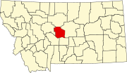 | |
| Town | ||
| CDPs | ||
| Other community | ||
| Ghost town | ||