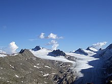
Hochwilde
| Hochwilde | |
|---|---|
| Altissima | |
 | |
| Highest point | |
| Elevation | 3,482 m (11,424 ft) |
| Prominence | 343 m (1,125 ft) |
| Parent peak | Schalfkogel |
| Isolation | 6.2 km (3.9 mi) |
| Listing | Alpine mountains above 3000 m |
| Coordinates | 46°45′59″N 11°1′25″E / 46.76639°N 11.02361°E |
| Geography | |
| Location | Tyrol, Austria / South Tyrol, Italy |
| Parent range | Ötztal Alps |
| Climbing | |
| First ascent | 1858 by J. Ganahl with peasants and shepherds |
| Easiest route | South ridge from the Stettiner Hütte (marked route) |
The Hochwilde or Hohe Wilde (Italian: Altissima) is a mountain in the Ötztal Alps on the border between Tyrol, Austria, and South Tyrol, Italy.
References[edit]
- Austrian Alpenverein (in German)
- Alpenverein South Tyrol (in German)
External links[edit]
![]() Media related to Hochwilde at Wikimedia Commons
Media related to Hochwilde at Wikimedia Commons

