
Hot Springs Landing, New Mexico
Hot Springs Landing, New Mexico | |
|---|---|
Census-designated place | |
 Hot Springs Landing, New Mexico | |
| Coordinates: 33°12′17″N 107°12′36″W / 33.20472°N 107.21000°W | |
| Country | United States |
| State | New Mexico |
| County | Sierra |
| Area | |
| • Total | 0.45 sq mi (1.17 km2) |
| • Land | 0.45 sq mi (1.17 km2) |
| • Water | 0.00 sq mi (0.00 km2) |
| Elevation | 4,534 ft (1,382 m) |
| Population | |
| • Total | 120 |
| • Density | 266.08/sq mi (102.82/km2) |
| Time zone | UTC-7 (Mountain (MST)) |
| • Summer (DST) | UTC-6 (MDT) |
| Area code | 575 |
| GNIS feature ID | 2584114[2] |
Hot Springs Landing is a census-designated place in Sierra County, New Mexico, United States. Its population was 110 as of the 2010 census.[4] The community is located on the western shore of Elephant Butte Reservoir.
Geography[edit]
Hot Springs Landing is located at 33°12′17″N 107°12′36″W / 33.204673°N 107.209988°W. According to the U.S. Census Bureau, the community has an area of 0.453 square miles (1.17 km2), all land.[4]
Demographics[edit]
| Census | Pop. | Note | %± |
|---|---|---|---|
| 2020 | 120 | — | |
| U.S. Decennial Census[5][3] | |||
Education[edit]
Truth or Consequences Municipal Schools is the school district for the entire county.[6] Truth or Consequences Middle School and Hot Springs High School, both in Truth or Consequences, are the district's secondary schools.
References[edit]
- ^ "ArcGIS REST Services Directory". United States Census Bureau. Retrieved October 12, 2022.
- ^ a b U.S. Geological Survey Geographic Names Information System: Hot Springs Landing, New Mexico
- ^ a b "Census Population API". United States Census Bureau. Retrieved October 12, 2022.
- ^ a b "2010 Census Gazetteer Files - Places: New Mexico". U.S. Census Bureau. Retrieved December 7, 2015.
- ^ "Census of Population and Housing". Census.gov. Retrieved June 4, 2016.
- ^ "2020 CENSUS - SCHOOL DISTRICT REFERENCE MAP: Sierra County, NM" (PDF). U.S. Census Bureau. Retrieved July 12, 2022. - Text list
Municipalities and communities of Sierra County, New Mexico, United States | ||
|---|---|---|
| Cities | 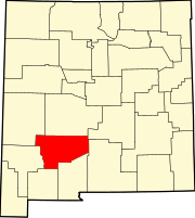 | |
| Villages | ||
| CDPs | ||
| Other communities | ||
| Ghost towns | ||
This New Mexico state location article is a stub. You can help Wikipedia by expanding it. |