
Joseph-Édouard Perrault Bridge
Joseph-Édouard-Perrault bridge | |
|---|---|
 Covered bridge spanning the "Rivière des Pins" at Warwick | |
| Coordinates | 45°57′23″N 72°00′24″W / 45.956250°N 72.006583°W |
| Crosses | Rivière des Pins |
| Locale | Warwick, Quebec, Canada |
| Characteristics | |
| Total length | 30.2 metres (99 ft) |
| Location | |
 | |
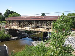
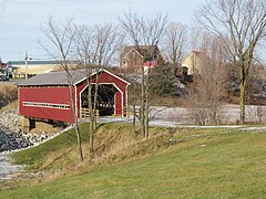
The Joseph-Édouard-Perrault bridge, formerly known as the Pont Perrault-Charbonneau, is a covered bridge located at Warwick, Quebec, Canada. Built in 1908, it was used for automobile traffic until 1957. It was classified historical monument in 1999.
History[edit]
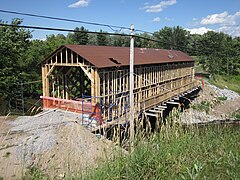
Acquired by the Municipality of Warwick in 1998, the bridge was completely renovated in 2011. The bridge was re-opened on September 26, 2011.[1] following an investment of $340,000.[2]
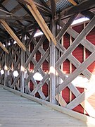
Gallery[edit]
-
 Rénovations, July 2011
 -
 Rénovations, July 2011
 -
 December 2011
 -
 December 2011
 -
 December 2011


References[edit]
- ^ Thibodeau, Claude (6 September 2011). "An official inauguration for the renovated bridge". La Nouvelle Union.
- ^ Thibodeau, Claude (2 May 2011). "Covered bridge: a Cowansville firm selected for the restoration". La Nouvelle Union.
External links[edit]
- "Covered bridge of Warwick". Heritage directory culture of Quebec.
This article about a specific bridge in Quebec is a stub. You can help Wikipedia by expanding it. |