
Kjøpsvik
Village | |
 View of the village harbour | |
 Kjøpsvik Location of the village  Kjøpsvik Kjøpsvik (Norway) | |
| Coordinates: 68°05′46″N 16°22′25″E / 68.0961°N 16.3737°E | |
| Country | Norway |
| Region | Northern Norway |
| County | Nordland |
| District | Ofoten |
| Municipality | Narvik |
| Area | |
| • Total | 1.01 km2 (0.39 sq mi) |
| Elevation | 34 m (112 ft) |
| Population (2018)[1] | |
| • Total | 845 |
| • Density | 837/km2 (2,170/sq mi) |
| Time zone | UTC+01:00 (CET) |
| • Summer (DST) | UTC+02:00 (CEST) |
| Post Code | 8590 Kjøpsvik |
| Climate | Dfc |
Kjøpsvik (Norwegian) or Gásluokta (Northern Sami) is a village in Narvik Municipality in Nordland county, Norway. The village is located on the eastern shore of the Tysfjorden, north of the small village of Storå. The island of Hulløya lies off the coast of Kjøpsvik. The 1.01-square-kilometre (250-acre) village has a population (2018) of 845 which gives the village a population density of 837 inhabitants per square kilometre (2,170/sq mi).[1]
There are regular ferry connections as part of Norwegian National Road 827 from Kjøpsvik to Drag, across the fjord. The local Kjøpsvik Church serves the residents of this part of the Tysfjord parish. The main industry in Kjøpsvik is the Norcem cement factory.[3]
The village was the administrative centre of the old municipality of Tysfjord until 1 January 2020 when Tysfjord was dissolved.
Media gallery[edit]
-
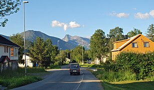 View of the main road in Kjøpsvik
 -
 Kjøpsvik ferry port
 -
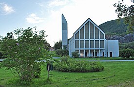 Kjøpsvik Church


References[edit]
- ^ a b c Statistisk sentralbyrå (1 January 2018). "Urban settlements. Population and area, by municipality".
- ^ "Kjøpsvik, Tysfjord (Nordland)". yr.no. Retrieved 2019-01-14.
- ^ Store norske leksikon. "Kjøpsvik" (in Norwegian). Retrieved 2012-05-15.
This Nordland location article is a stub. You can help Wikipedia by expanding it. |